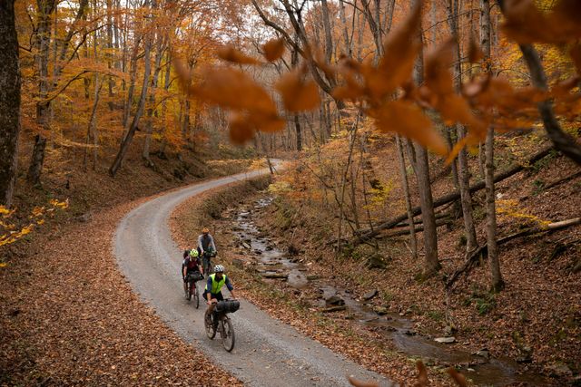
TransVirginia Bike Route - Mountain 565 - Official 2025 (Southbound)
**Route Closures and Relief Efforts - https://www.transvirginia.org/hurricane-helene-impact-and-community-support/ **
Washington, DC to Damascus, VA
562.9 miles / 47,584'
Updated 4/3/2025
Official TransVirginia Route
*Includes new reroute of VA Creeper Trail*
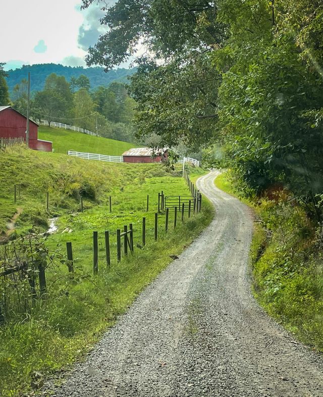
"The Gravel Road to Damascus"
https://www.transvirginia.org/routes/transva550/
Brown = unpaved
Resupply & Overnights: https://docs.google.com/spreadsheets/d/e/2PACX-1vQQAotDVBuvn4_kY4QFbMWjRmWUXlGyxgCtjvbbyc8p6zduPZ2vdKdUHOQ2AusWLiVIQvKDfESBi2sc/pubhtml
https://www.buymeacoffee.com/dplandis
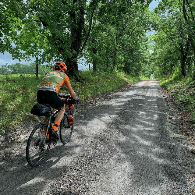
TransVA Valley 535 - 2025 Official (Southbound)
**Route Closures and Relief Efforts - https://www.transvirginia.org/hurricane-helene-impact-and-community-support/ **
Washington, DC to Damascus, VA
534.1 miles / 34,211′
Updated 4/3/2025
Official TransVirginia Route
Brown = unpaved
"The Gravel Road to Damascus"
https://www.transvirginia.org/routes/valley-transva520/
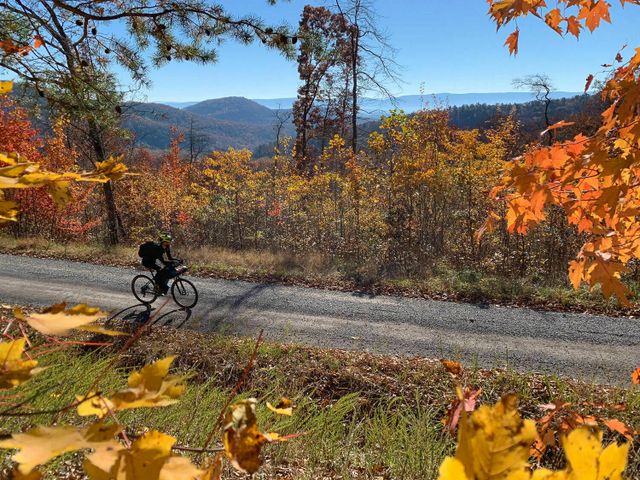
This is a more approachable ALTERNATE ROUTE based on the full TransVA route that:
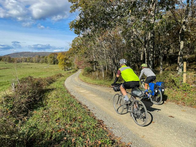
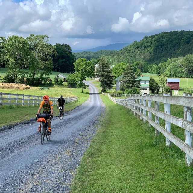
Favors state-maintained gravel roads over rough surfaces (like singletrack and less maintained doubletrack).
Has 11k’ less climbing, following the valleys more than the high ridges. Other than the high paved road climb up to Whitetop near the route’s end, elevations stay below 3000′.
Can be ridden on a gravel/all road bike with 32-45mm tires more comfortably
Intersects the main TransVA route periodically, allowing riders to jump up (for more challenge) or down (if you think you’re in over your head on the tougher route)
Has more options for resupply and lodging
*Note that the climb on Alum Spring Rd into Pulaski is rough gravel and steep. The southern option on Robinson Tract Rd is 7 miles longer, but is all paved. See waypoint for turnoff.
Resupply & Overnights: https://docs.google.com/spreadsheets/d/e/2PACX-1vQWaJL83YeVRKRRHIIrDZ_PFK0L8VWrH1eKCKeiViNatc74P96IKZQmIwbqSdmMgEsSJeCelbJdPTWH/pubhtml
https://www.buymeacoffee.com/dplandis
DC Harrisonburg 400 LOOP- Official
400 miles / 23,333′
Updated 5/26/24
Official TransVirginia Route
Brown = unpaved
Starts with the Valley 535 from DC to Harrisonburg;
Returns to DC on an eastern route
Favors state-maintained gravel roads over rough surfaces (like singletrack and less maintained doubletrack).
Can be ridden on a gravel/all road bike with 32-45mm tires more comfortably
Note! Trail Pass required to cross over Massanutten Western Slope Trails on gravel Del Webb Dr. $10/day pass and proceeds support SVBC: https://svbcoalition.org/ride/trail-passes/day-pass/
Resupply Datasheet: https://docs.google.com/spreadsheets/d/e/2PACX-1vRdZjieB1meNauVhKCKQNXw0RfmwPFY97ccMMVeln4bNq9CX6AN3hCQ_2-5TgLjsgsPLGmiRBM5sp_c/pubhtml
https://www.buymeacoffee.com/dplandis
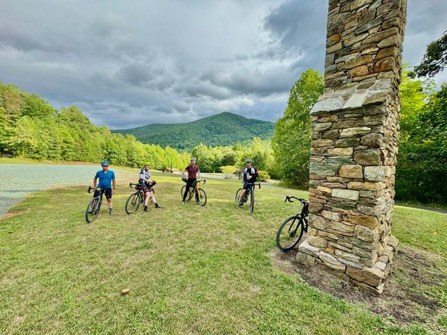
The Blue Ridge Hills and Hollows (BRHH) gravel bikepacking loop connects eight county memorials via a 300-mile mixed-surface cycling route around Virginia’s Shenandoah National Park (SNP).
These memorials pay homage to the families and communities that lost their homes, land, and livelihoods in the Blue Ridge Mountains due to the formation of the national park in the 1930s.
Additional planning information at https://hillsandhollows.org
The multi-day route connects to the Blue Ridge Parkway and Skyline Drive (https://ridewithgps.com/routes/44254372), and can be approached from numerous starting points for camping and hotel-based itineraries.
The route also intersects many historic dirt roads that crossed the Blue Ridge via its east-west valleys, presenting opportunities for ambitious cyclists to climb to the edge of the park’s perimeter boundary (bikes are not permitted on dirt roads in the park, but foot traffic is possible).
See route add-on options: https://ridewithgps.com/collections/2145858 including an adventurous alternate via Veach Gap west of Front Royal with free camping options enroute (https://ridewithgps.com/routes/44255259).
v6, updated 3/28/24
**Hurricane Helene Route Closures and Relief Efforts - https://www.transvirginia.org/hurricane-helene-impact-and-community-support/ **
Based on the Grayson Gravel Traverse: https://ridewithgps.com/routes/38628715
More information at https://www.graysoncountyva.com/business/grayson-gravel-traverse-bike-route/
Explore centuries-old dirt roads, canalways and rail corridors west of Washington DC along the Potomac River and into northern Virginia which date back more than 250 years. This four-day journey leaves the nation’s capital along the famous Chesapeake and Ohio (C&O) canal towpath to enter Loudoun County, Virginia, through historic horse and wine country on low-traffic gravel roads that local cyclists champion as a national treasure to be protected for years to come. Return to DC on the popular, low-stress Washington & Old Dominion (W&OD) paved rail trail to finish the loop back at the Lincoln Memorial on the National Mall. This route highlights much of the best riding in the area and is built upon expertise in the local cycling community, favorite coffee and brewery stops, and national historic points of interest that extend from Washington, DC into northern Virginia. This route is on the land of the Nacotchtank (Anacostan), Piscataway and Manahoac.
The route in full totals 194 miles with 9,092 feet of elevation gained, mostly in the middle 100 miles of the itinerary. Only 20% of the entire route is on paved roads shared with cars, with around 50% on C&O and W&OD greenways and another 60+ miles on quiet gravel country roads. Camping is available along the C&O and at Sky Meadows State Park, and various B&Bs and hotels throughout other parts of the route offer lodging. It’s possible to connect Purcellville to Leesburg on the W&OD, offering shorter routes that are primarily rail trail or gravel roads, or a combination best for camping or indoor overnight lodging. Gravel or touring bikes with a minimum of 28mm tires (32-38mm recommended) that are geared for moderate, short climbing grades are best for this route. Unpaved surfaces are generally well-maintained, making the terrain fine for both rack/pannier and bikepacking bag friendly. The route is best navigated using a cycling GPS computer such as a Garmin Edge or Wahoo Elemnt, or the RideWithGPS app on a smartphone.
Designed by David Landis
David is an avid cyclist, bikepacker and route designer based in Harrisonburg, Virginia. His professional outdoor adventure career began with a round-the-world journey that led to the development of various long-distance trails in the Middle East and Asia, as well as the publication of guidebooks for the Camino de Santiago through Village to Village Press. David has spent the last few years exploring unpaved roads and trails surrounding the Shenandoah Valley in Virginia and West Virginia, and has designed the 550-mile gravel TransVirginia Bike
Updated 11/8/2021
Campgrounds throughout route. Good rolling hills without any crazy climbs. Beautiful gravel roads around the edges of the Shenandoah Valley.
Returns SW on TransVA Valley Route (transva.org).
Food/resupply waypoints marked.
Updated 11/22/23
BIG climbing route with steep WV grades. Strong legs and low gears!
This is a very challenging course and should not be your first bikepacking trip.
Here's a logical progression of nearby bikepacking routes from beginner to this:
1) GAP 150 / C&O 185 (rail trail, flat or very low grade climbing, good gravel surfaces)
2) TransVA Valley Route 525 (state maintained gravel/dirt and paved country roads, moderate climbs and grades): https://ridewithgps.com/routes/31322054
3) TransVA 550 (Steeper, longer climbing with some sections of rough gravel / doubletrack and short singletrack connectors: https://ridewithgps.com/routes/26868478), Rockstar Gravel 255 or AML 400
4) Sods Circuit (lots of huge climbs and steep grades, a few rougher surfaces over Pike Knob but overall fairly good gravel throughout)


