Mobile App
Plans
Route Planner
Organizations
Explore
Stories
English
Log In
Sign up
Sign up
Kevin Matherly
Follow
Message
Stats
2025
- -
Feet Traveled
- -
Feet of Elevation Gained
- -
Activities
- -
Active Hour
- -
Calories Burned
- -
Photos Taken
Week
Month
Year
Career
Recent Routes & Activities
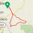
Sandy creek- La Panza
Paso Robles, CA
43.7 mi
2,600 ft
Santa Mag. to 41 lake
Atascadero, CA
36.2 mi
2,079 ft
46 to lookout and back
El Paso de Robles (Paso Robles), CA
37.3 mi
4,335 ft
ride from home
Paso Robles, CA
37.1 mi
2,121 ft
ride from home
Paso Robles, CA
37.1 mi
2,121 ft
41 to O dovan
Atascadero, CA
41.4 mi
1,893 ft
top of Rinconda
Atascadero, CA
41.4 mi
1,742 ft
41 to Santa Margarita
Atascadero, CA
36.3 mi
1,994 ft
41 to Cripple creek
Atascadero, CA
41.3 mi
2,278 ft
(unnamed)
San Luis Obispo County, CA
40.7 mi
2,093 ft
(unnamed)
San Luis Obispo County, CA
40.7 mi
2,093 ft
coast ride
San Luis Obispo County, CA
40.8 mi
2,093 ft
pozo loop short
San Luis Obispo County, CA
40.8 mi
2,616 ft
Rincondia
Atascadero, CA
45.4 mi
1,936 ft
Rincondia
Atascadero, CA
45.4 mi
1,936 ft
hura hura pozo
San Luis Obispo, CA
62.4 mi
3,501 ft
kdm coffee ride
Atascadero, California
41.3 mi
2,135 ft
Follows
1 follower
1 following
Mike Q
Recent Photos
This user has not uploaded any photos
Get Inspired, Not Lost. © 2025 Ride with GPS.
Terms of Service
.
Privacy Policy
.
Mobile App
Mobile Route Planner
Web Route Planner
Integrations
Organizations
Experiences
Cycling Clubs
Cycling Events
Regions
About Us
Global Ambassadors
Careers
Contact
Help Center
Facebook
Twitter
Instagram
YouTube