Mobile App
Plans
Route Planner
Organizations
Explore
Stories
English
Log In
Sign up
Sign up
Marge Smith
Saint Kilda, 07, AU
Follow
Message
Stats
2025
- -
Feet Traveled
- -
Feet of Elevation Gained
- -
Activities
- -
Active Hour
- -
Calories Burned
- -
Photos Taken
Week
Month
Year
Career
Recent Routes & Activities
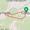
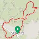
Trentham Domino Trail loop
Trentham, Victoria
8.7 mi
449 ft
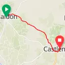
Maldon-Castlemaine Rail Trail
Maldon, Victoria
12.3 mi
448 ft
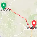
Maldon-Castlemaine Rail Trail
Maldon, Victoria
12.3 mi
494 ft
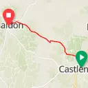
Castlemaine-Maldon Rail Trail Alternative
Castlemaine, Victoria
11.3 mi
711 ft
Castlemaine-Maldon Rail Trail Alternative
Castlemaine, Victoria
11.3 mi
697 ft
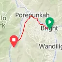
Directions from Bright, Victoria to Buckland Valley Road, Buckland, Victoria
Bright, Victoria
10 mi
469 ft
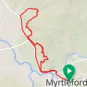
Myrtleford Gapsted Loop (Alt. Standish Street)
Myrtleford, Victoria
14.9 mi
1,060 ft
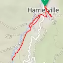
Harrietville Out & Back (V2)
Harrietville, Victoria
6.9 mi
594 ft
Harrietville Out & Back (V2)
Harrietville, Victoria
6.9 mi
594 ft
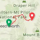
Beechworth - Yackandandah - Osbornes Flat
Beechworth, Victoria
20.3 mi
837 ft
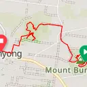
Mwwc Buninyong part 2
Ballarat, Victoria
7.2 mi
343 ft
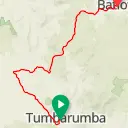
(unnamed)
Tumbarumba, New South Wales
38.2 mi
3,353 ft
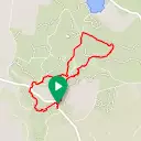
MWWC Sutherland creek check 5.5 km
She Oaks, Victoria
3.5 mi
439 ft
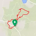
MWWC Southerland Creek Circuit 17km
She Oaks, Victoria
10.4 mi
1,102 ft
MWWC Sutherland Creek 18 km
She Oaks, Victoria
11.4 mi
1,146 ft
MWWC Sutherland Creek circuit 13km
She Oaks, Victoria
8.3 mi
956 ft
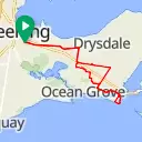
Out to Point Lonsdale
Geelong, Victoria
43.9 mi
1,404 ft
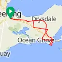
Showgrounds to Point Lonsdale
Geelong, Victoria
42.7 mi
1,291 ft
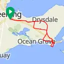
Showgrounds to Pt Lonsdale
Geelong, Victoria
42.7 mi
1,322 ft
Barrabool Loop
Fyansford, Victoria
32.7 mi
1,863 ft
Follows
1 follower
2 following
JoJo Vivente
Recent Photos
Get Inspired, Not Lost. © 2025 Ride with GPS.
Terms of Service
.
Privacy Policy
.
Mobile App
Mobile Route Planner
Web Route Planner
Integrations
Organizations
Experiences
Cycling Clubs
Cycling Events
Regions
About Us
Global Ambassadors
Careers
Contact
Help Center
Facebook
Twitter
Instagram
YouTube