OCC Enduro-70.5 |

|
Route-overzicht
Self-Supported Cycling in the Driftless Region
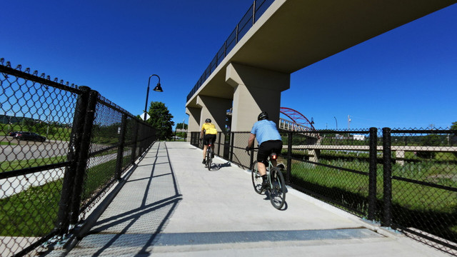
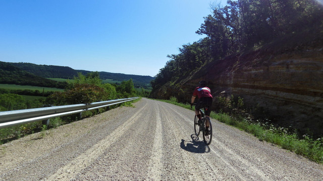
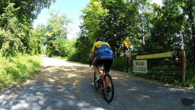
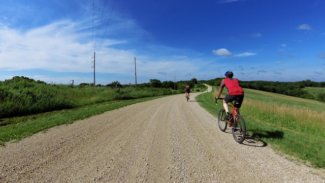
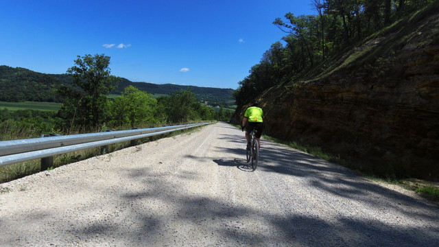
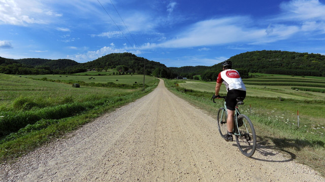
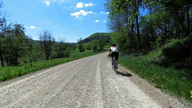
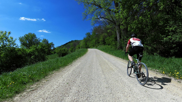
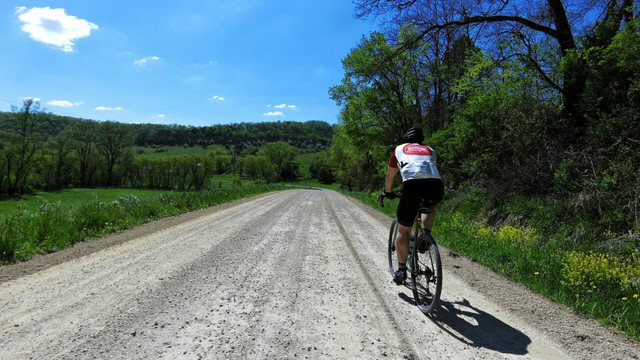
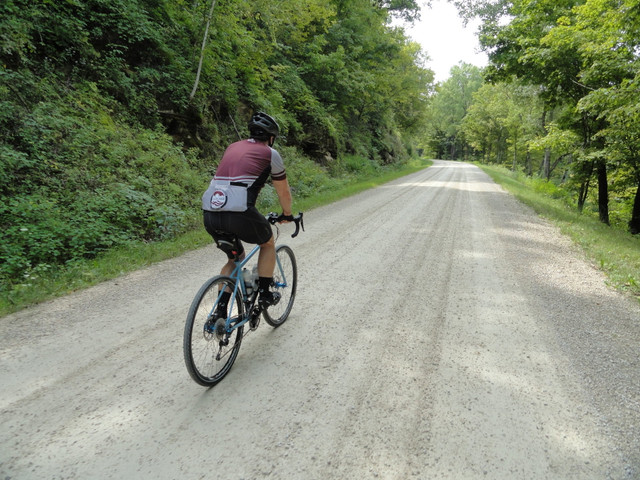
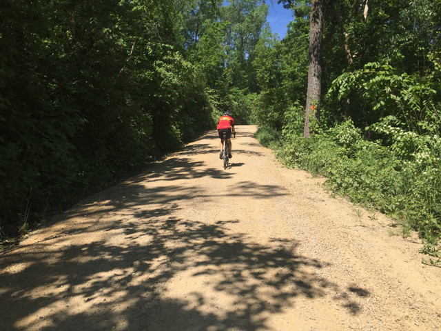
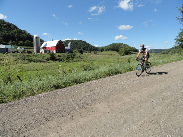
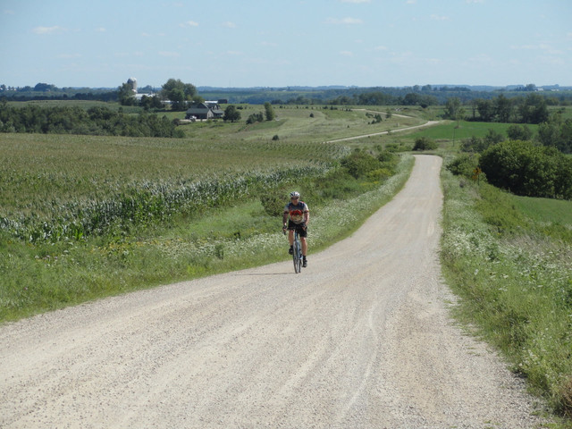
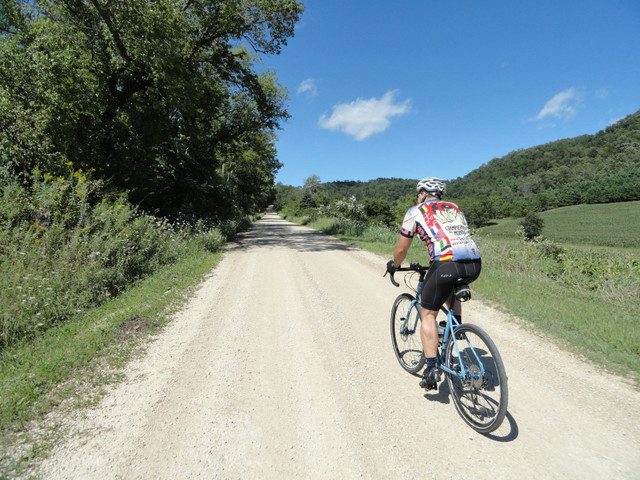
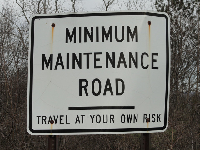
With just under 34 miles of gravel, this route starting in La Crescent, Minnesota is harder than you might think -- climbing nearly 4,000 feet with six major hills, this is no ride in the park.
Routedetails
Andere routes van Driftless Cycling
Driftless Region's Most Scenic Ride-82 miles
Self-Supported Cycling in the Driftless Region
This challenging ride has four big climbs, including steep and scenic Tschumper Road. But cyclis... more
This challenging ride has four big climbs, including steep and scenic Tschumper Road. But cyclists are rewarded with many rest stops, and stunning views of the Mississippi and Root River valleys. (less)
This challenging ride has four big climbs, including steep and scenic Tschumper Road. But cyclists are rewarded with many rest stops, and stunning views of the Mississippi and Root River valleys.
This challenging ride has four big climbs, including steep and scenic Tschumper Road. But cyclists are rewarded with many rest stops, and stunning views of the Mississippi and Root River valleys. (less)
L-N-L (La Crescent-Nodine-La Crescent ) 58.3 Gravel
Self-Supported Cycling in the Driftless Region
This route is our version of a European classic, like Liège–Bastogne–Liège except not as famous. ... more
This route is our version of a European classic, like Liège–Bastogne–Liège except not as famous. With five steep climbs and six gravel sections (no cobblestones, sorry) it was our first published gravel route in the Driftless region, kicking off all kinds of local gravel riding. (less)
This route is our version of a European classic, like Liège–Bastogne–Liège except not as famous. With five steep climbs and six gravel sections (no cobblestones, sorry) it was our first published gravel rout...more
This route is our version of a European classic, like Liège–Bastogne–Liège except not as famous. With five steep climbs and six gravel sections (no cobblestones, sorry) it was our first published gravel route in the Driftless region, kicking off all kinds of local gravel riding. (less)
Whitehall English Century-100 mile
Self-Supported Cycling in the Driftless Region
This route tours some of the best of rural Wisconsin through the small towns of Trempealeau, Arcadia, Whitehall and Galesville. It's a scenic hundred miles with no killer hills.
This route tours some of the best of rural Wisconsin through the small towns of Trempealeau, Arcadia, Whitehall and Galesville. It's a scenic hundred miles with no killer hills. (less)
Baristas Epic Coffee Ride-46 miles
Self-Supported Cycling in the Driftless Region
It's the coffee at the halfway point that makes the short version of this route into an epic outi... more
It's the coffee at the halfway point that makes the short version of this route into an epic outing. Cross the Mississippi and climb five easy hills as you head out and back along the flat bottom of the Root River valley. (less)
It's the coffee at the halfway point that makes the short version of this route into an epic outing. Cross the Mississippi and climb five easy hills as you head out and back along the flat bottom of the Root...more
It's the coffee at the halfway point that makes the short version of this route into an epic outing. Cross the Mississippi and climb five easy hills as you head out and back along the flat bottom of the Root River valley. (less)
North East Route-62 miles
Self-Supported Cycling in the Driftless Region
A study in contrast on this route northeast of La Crosse -- straight shots through flat rural farmland, followed by winding climbs over two challenging hills.
A study in contrast on this route northeast of La Crosse -- straight shots through flat rural farmland, followed by winding climbs over two challenging hills. (less)
Coon Valley Coulee Express-56 miles
Self-Supported Cycling in the Driftless Region
What's a coulee? With four challenging climbs in a 56 mile loop, this is the fastest way to find out.
What's a coulee? With four challenging climbs in a 56 mile loop, this is the fastest way to find out. (less)
Stoddard - Chaseburg loop - 38 miles
Self-Supported Cycling in the Driftless Region
Just got time for a quick ride? This popular loop heads south out of La Crosse on a flat, straight highway; then up a quiet farm valley before returning up a challenging hill.
Just got time for a quick ride? This popular loop heads south out of La Crosse on a flat, straight highway; then up a quiet farm valley before returning up a challenging hill. (less)
Ridgeway Rampage - 56 Gravel
Self-Supported Cycling in the Driftless Region
Charge full speed ahead through the valleys and ridges north of Houston, Minnesota. Ride 56 miles... more
Charge full speed ahead through the valleys and ridges north of Houston, Minnesota. Ride 56 miles, with four major climbs and seven gravel sections totaling more than two-thirds of the total distance. (less)
Charge full speed ahead through the valleys and ridges north of Houston, Minnesota. Ride 56 miles, with four major climbs and seven gravel sections totaling more than two-thirds of the total distance.
Charge full speed ahead through the valleys and ridges north of Houston, Minnesota. Ride 56 miles, with four major climbs and seven gravel sections totaling more than two-thirds of the total distance. (less)
Hokah Hilly Hundred-66 Gravel
Self-Supported Cycling in the Driftless Region
Call it the "Triple H," a hilly hundred kilometers from Hokah, Minnesota to New Albin, Iowa, and ... more
Call it the "Triple H," a hilly hundred kilometers from Hokah, Minnesota to New Albin, Iowa, and back. It's got just under 5,000 ft. of climbing over 65.8 miles, with nine gravel sections making up more than three-quarters of the total route. (less)
Call it the "Triple H," a hilly hundred kilometers from Hokah, Minnesota to New Albin, Iowa, and back. It's got just under 5,000 ft. of climbing over 65.8 miles, with nine gravel sections making up more th...more
Call it the "Triple H," a hilly hundred kilometers from Hokah, Minnesota to New Albin, Iowa, and back. It's got just under 5,000 ft. of climbing over 65.8 miles, with nine gravel sections making up more than three-quarters of the total route. (less)
West Salem Dairy Days Classique-66 miles
Self-Supported Cycling in the Driftless Region
You don't have to wait for June Dairy Days to ride this moderately hard route. Four medium climbs dot this 66 mile loop north from West Salem into farms and forests.
You don't have to wait for June Dairy Days to ride this moderately hard route. Four medium climbs dot this 66 mile loop north from West Salem into farms and forests. (less)
Grandad Bluff Loop-23 miles
Self-Supported Cycling in the Driftless Region
While it's currently the shortest ride in our inventory, this loop still has two climbs -- one of which is pretty challenging. But the view from Grandad Bluff is worth it!
While it's currently the shortest ride in our inventory, this loop still has two climbs -- one of which is pretty challenging. But the view from Grandad Bluff is worth it! (less)
Apple Blossom Loop-35 Miles
Self-Supported Cycling in the Driftless Region
A quick and scenic loop out from La Crosse through Minnesota's apple orchards, with one fairly gradual climb, great views over the Mississippi, and a sweeping descent into La Crescent.
A quick and scenic loop out from La Crosse through Minnesota's apple orchards, with one fairly gradual climb, great views over the Mississippi, and a sweeping descent into La Crescent. (less)
Norski Tur - 100 miles
Self-Supported Cycling in the Driftless Region
Explore the diverse geography southeast of La Crosse, settled by Norwegian immigrants. Long valleys, open fields and the occasional ski jump make it unique.
Explore the diverse geography southeast of La Crosse, settled by Norwegian immigrants. Long valleys, open fields and the occasional ski jump make it unique. (less)
Cheddarman 76.4
Self-Supported Cycling in the Driftless Region
Have you been eating too much cheese for your own good? This challenging training route for Ironman Wisconsin has 68 small hills (or rollers) to give riders a fitness challenge.
Have you been eating too much cheese for your own good? This challenging training route for Ironman Wisconsin has 68 small hills (or rollers) to give riders a fitness challenge. (less)
Goose Island-Stoddard, Out and Back-31 miles
Self-Supported Cycling in the Driftless Region
Flat, quick out-and-back along Mississippi River, with a wide shoulder along busy Highway 35 and a side trip through Goose Island County Park.
Flat, quick out-and-back along Mississippi River, with a wide shoulder along busy Highway 35 and a side trip through Goose Island County Park. (less)
Baristas Epic Coffee Ride 55 mile loop
Self-Supported Cycling in the Driftless Region
Make your coffee ride even more epic by adding eleven miles and one big climb to the standard rou... more
Make your coffee ride even more epic by adding eleven miles and one big climb to the standard route. Cross the Mississippi and make a loop in the scenic Root River valley before hitting one big climb on the return. (less)
Make your coffee ride even more epic by adding eleven miles and one big climb to the standard route. Cross the Mississippi and make a loop in the scenic Root River valley before hitting one big climb on the ...more
Make your coffee ride even more epic by adding eleven miles and one big climb to the standard route. Cross the Mississippi and make a loop in the scenic Root River valley before hitting one big climb on the return. (less)
Swede Bottom - 76 Gravel
Self-Supported Cycling in the Driftless Region
It's a hilly, mostly-gravel tour through the edge of the driftless, including a final gravel desc... more
It's a hilly, mostly-gravel tour through the edge of the driftless, including a final gravel descent down historic and secluded Swede Bottom Road. Seventy-six miles, nine gravel sections, and over five thousand feet of climbing are broken up with rest stops in Caledonia and Hokah.
(less)
It's a hilly, mostly-gravel tour through the edge of the driftless, including a final gravel descent down historic and secluded Swede Bottom Road. Seventy-six miles, nine gravel sections, and over five thous...more
It's a hilly, mostly-gravel tour through the edge of the driftless, including a final gravel descent down historic and secluded Swede Bottom Road. Seventy-six miles, nine gravel sections, and over five thousand feet of climbing are broken up with rest stops in Caledonia and Hokah.
(less)
Middle Ridge Ramble-58 miles
Self-Supported Cycling in the Driftless Region
Scenic, rolling, fast: it's the Middle Ridge Ramble, a double loop up and down the Driftless ridg... more
Scenic, rolling, fast: it's the Middle Ridge Ramble, a double loop up and down the Driftless ridges southeast of La Crosse. This road rides includes areas that are not explored by any other Driftless Cycling route. (less)
Scenic, rolling, fast: it's the Middle Ridge Ramble, a double loop up and down the Driftless ridges southeast of La Crosse. This road rides includes areas that are not explored by any other Driftless Cycling...more
Scenic, rolling, fast: it's the Middle Ridge Ramble, a double loop up and down the Driftless ridges southeast of La Crosse. This road rides includes areas that are not explored by any other Driftless Cycling route. (less)

