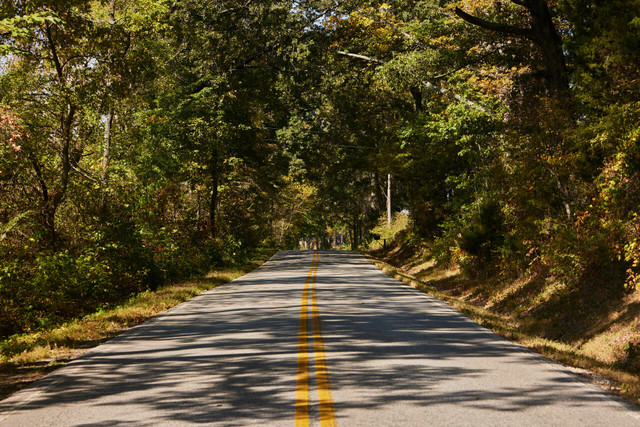
West Tennessee Classic Loop |

|

ルートの概要
For those craving an authentic West Tennessee cycling experience, look no further. This ride offers low-traffic rural roads and wide open farm fields, showcasing the state's agrarian charm.
ルートの詳細
Bike TNによる他のルート
Fall Creek Falls Loop
Discover the allure of Tennessee's most-visited state park, Fall Creek Falls State Park, which is... more
Discover the allure of Tennessee's most-visited state park, Fall Creek Falls State Park, which is home to Tennessee's tallest waterfall and a vast 30,000-acre wilderness. This route offers the best of both worlds: rolling roadways and dedicated trails within the park, as well as picturesque country roads beyong its borders. Plan to ride on weekdays or early mornings to savor the tranquility and natural beauty of this state park treasure. (less)
Discover the allure of Tennessee's most-visited state park, Fall Creek Falls State Park, which is home to Tennessee's tallest waterfall and a vast 30,000-acre wilderness. This route offers the best of both w...more
Discover the allure of Tennessee's most-visited state park, Fall Creek Falls State Park, which is home to Tennessee's tallest waterfall and a vast 30,000-acre wilderness. This route offers the best of both worlds: rolling roadways and dedicated trails within the park, as well as picturesque country roads beyong its borders. Plan to ride on weekdays or early mornings to savor the tranquility and natural beauty of this state park treasure. (less)
Cummins Falls Out & Back
The Cummins Falls Out-and-Back is a low-traffic ride that you can easily combine with a trip to b... more
The Cummins Falls Out-and-Back is a low-traffic ride that you can easily combine with a trip to beautiful Cummins Falls State Park. The park makes a great place to start, not only because of the first-class visitor center and large parking lot, but also because it’s a beautiful place to explore after the ride, with both an easy walk to the overlook and a more involved hike down to the gorge and the swimming hole below the waterfall. The ride is relatively short, so you’ll have plenty of time to enjoy the park afterwards. (less)
The Cummins Falls Out-and-Back is a low-traffic ride that you can easily combine with a trip to beautiful Cummins Falls State Park. The park makes a great place to start, not only because of the first-class ...more
The Cummins Falls Out-and-Back is a low-traffic ride that you can easily combine with a trip to beautiful Cummins Falls State Park. The park makes a great place to start, not only because of the first-class visitor center and large parking lot, but also because it’s a beautiful place to explore after the ride, with both an easy walk to the overlook and a more involved hike down to the gorge and the swimming hole below the waterfall. The ride is relatively short, so you’ll have plenty of time to enjoy the park afterwards. (less)
York Historic Park Challenge
Beautiful scenery, fun roads, and a ton of climbing (some of which is quite steep) add up to make... more
Beautiful scenery, fun roads, and a ton of climbing (some of which is quite steep) add up to make this ride both challenging and rewarding. The ride starts at Sgt. Alvin C. York State Historic Park, which pays tribute to one of the most decorated soldiers of World War I, while also providing access to the historic York farm and homestead. (less)
Beautiful scenery, fun roads, and a ton of climbing (some of which is quite steep) add up to make this ride both challenging and rewarding. The ride starts at Sgt. Alvin C. York State Historic Park, which pa...more
Beautiful scenery, fun roads, and a ton of climbing (some of which is quite steep) add up to make this ride both challenging and rewarding. The ride starts at Sgt. Alvin C. York State Historic Park, which pays tribute to one of the most decorated soldiers of World War I, while also providing access to the historic York farm and homestead. (less)
Pinson Mounds Loop
Cycle through an ancient landscape at Pinson Mounds State Archeological Park. The park preserves ... more
Cycle through an ancient landscape at Pinson Mounds State Archeological Park. The park preserves more than 15 earthen mounds, some towering more than 70 feet high and dating back 2,000 years. This route offers enough climbing to provide a satisfying workout, without leaving you exhausted for a post-ride stroll through the park. (less)
Cycle through an ancient landscape at Pinson Mounds State Archeological Park. The park preserves more than 15 earthen mounds, some towering more than 70 feet high and dating back 2,000 years. This route offe...more
Cycle through an ancient landscape at Pinson Mounds State Archeological Park. The park preserves more than 15 earthen mounds, some towering more than 70 feet high and dating back 2,000 years. This route offers enough climbing to provide a satisfying workout, without leaving you exhausted for a post-ride stroll through the park. (less)
Natchez Trace State Forest Loop
This loop route begins and ends at Natchez Trace State Forest grocery store and encircles the pre... more
This loop route begins and ends at Natchez Trace State Forest grocery store and encircles the preserved woodlands of nearby Natchez Trace State Park. These tree-covered roads are a rare treat in a largely agricultural region, offering cool shade during Tennessee's humid summer afternoons. The route explores some farmland roadways in the middle of the ride to balance out the scenery. There are several opportunities to venture off route to soak up the views at Pinoak, Red Bud and Cub Lake within the State Park. There are ample camping and lodging options within the park for those seeking a multi-day riding experience. (less)
This loop route begins and ends at Natchez Trace State Forest grocery store and encircles the preserved woodlands of nearby Natchez Trace State Park. These tree-covered roads are a rare treat in a largely ag...more
This loop route begins and ends at Natchez Trace State Forest grocery store and encircles the preserved woodlands of nearby Natchez Trace State Park. These tree-covered roads are a rare treat in a largely agricultural region, offering cool shade during Tennessee's humid summer afternoons. The route explores some farmland roadways in the middle of the ride to balance out the scenery. There are several opportunities to venture off route to soak up the views at Pinoak, Red Bud and Cub Lake within the State Park. There are ample camping and lodging options within the park for those seeking a multi-day riding experience. (less)
Upper Sequatchie Valley Loop
Some of the best riding in East Tennessee can be found in the Sequatchie Valley. That's why you'l... more
Some of the best riding in East Tennessee can be found in the Sequatchie Valley. That's why you'll find not just one, but three routes, each offering a unique perspective on the valley's geography and charm. The Upper Sequatchie Valley Loop will take you from Pikeville north to where the Sequatchie Valley begins. Enjoy the valley’s undulating, low-traffic roadways and historic agricultural landscape, as well as gorgeous views of Walden's Ridge and the South Cumberland Plateau. Pair this route with the Middle and/or Lower Sequatchie Loops for a multi-day riding expedition. (less)
Some of the best riding in East Tennessee can be found in the Sequatchie Valley. That's why you'll find not just one, but three routes, each offering a unique perspective on the valley's geography and charm....more
Some of the best riding in East Tennessee can be found in the Sequatchie Valley. That's why you'll find not just one, but three routes, each offering a unique perspective on the valley's geography and charm. The Upper Sequatchie Valley Loop will take you from Pikeville north to where the Sequatchie Valley begins. Enjoy the valley’s undulating, low-traffic roadways and historic agricultural landscape, as well as gorgeous views of Walden's Ridge and the South Cumberland Plateau. Pair this route with the Middle and/or Lower Sequatchie Loops for a multi-day riding expedition. (less)
Lower Sequatchie Valley Loop
Some of the best riding in East Tennessee can be found in the Sequatchie Valley. That's why you'l... more
Some of the best riding in East Tennessee can be found in the Sequatchie Valley. That's why you'll find not just one, but three routes, each offering a unique perspective on the valley's geography and charm. The Lower Sequatchie Valley Loop begins in Jasper, Tenn., and heads north through the valley toward the community of Cartwright, featuring fantastic roads and gorgeous views of Walden's Ridge and the South Cumberland Plateau, with unique stops along the way. Pair this route with the Middle and/or Upper Sequatchie Loops for a multi-day riding expedition. (less)
Some of the best riding in East Tennessee can be found in the Sequatchie Valley. That's why you'll find not just one, but three routes, each offering a unique perspective on the valley's geography and charm....more
Some of the best riding in East Tennessee can be found in the Sequatchie Valley. That's why you'll find not just one, but three routes, each offering a unique perspective on the valley's geography and charm. The Lower Sequatchie Valley Loop begins in Jasper, Tenn., and heads north through the valley toward the community of Cartwright, featuring fantastic roads and gorgeous views of Walden's Ridge and the South Cumberland Plateau, with unique stops along the way. Pair this route with the Middle and/or Upper Sequatchie Loops for a multi-day riding expedition. (less)
Chatata Valley Loop
The Chatata Valley Loop is a scenic ride featuring fun, twisty backroads through farmlands and ex... more
The Chatata Valley Loop is a scenic ride featuring fun, twisty backroads through farmlands and excellent pavement - plus a fantastic winery with a panoramic view of the mountains of the Cherokee National Forest. Don't be fooled by this route's short length - this is hill country, and many of the punchy climbs on this route are in the double-digit grades. So be prepared to gear down and power up the steep pitches. It's a challenging route that feels much longer than 25 miles, but it is well worth the effort to take in the surrounding mountains and scenery. (less)
The Chatata Valley Loop is a scenic ride featuring fun, twisty backroads through farmlands and excellent pavement - plus a fantastic winery with a panoramic view of the mountains of the Cherokee National For...more
The Chatata Valley Loop is a scenic ride featuring fun, twisty backroads through farmlands and excellent pavement - plus a fantastic winery with a panoramic view of the mountains of the Cherokee National Forest. Don't be fooled by this route's short length - this is hill country, and many of the punchy climbs on this route are in the double-digit grades. So be prepared to gear down and power up the steep pitches. It's a challenging route that feels much longer than 25 miles, but it is well worth the effort to take in the surrounding mountains and scenery. (less)
Bell Buckle Loop
Bell Buckle is set within Middle Tennessee's iconic countryside and has that Small Town America a... more
Bell Buckle is set within Middle Tennessee's iconic countryside and has that Small Town America appeal. This makes it a perfect place to launch a ride through the scenic landscape of South Central Tennessee, followed by rest and relax in the quaint town of Bell Buckle, Tenn. (less)
Bell Buckle is set within Middle Tennessee's iconic countryside and has that Small Town America appeal. This makes it a perfect place to launch a ride through the scenic landscape of South Central Tennessee,...more
Bell Buckle is set within Middle Tennessee's iconic countryside and has that Small Town America appeal. This makes it a perfect place to launch a ride through the scenic landscape of South Central Tennessee, followed by rest and relax in the quaint town of Bell Buckle, Tenn. (less)
Sewanee Loop
The Sewanee Loop route combines rolling roads through farmland with an exhilirating tree-covered ... more
The Sewanee Loop route combines rolling roads through farmland with an exhilirating tree-covered descent and climb back up Tennessee's South Cumberland Plateau. This ride begins and ends at the historic University of the South campus in Sewanee, Tenn., which is surrounded by the wilds of South Cumberland State Park and Savage Gulf State Park. You’ll be hard-pressed to get more bang for your buck on any 33-mile route, especially surrounded by the spectacular landscape of Tennessee's South Cumberland region. (less)
The Sewanee Loop route combines rolling roads through farmland with an exhilirating tree-covered descent and climb back up Tennessee's South Cumberland Plateau. This ride begins and ends at the historic Univ...more
The Sewanee Loop route combines rolling roads through farmland with an exhilirating tree-covered descent and climb back up Tennessee's South Cumberland Plateau. This ride begins and ends at the historic University of the South campus in Sewanee, Tenn., which is surrounded by the wilds of South Cumberland State Park and Savage Gulf State Park. You’ll be hard-pressed to get more bang for your buck on any 33-mile route, especially surrounded by the spectacular landscape of Tennessee's South Cumberland region. (less)
Natchez Trace Parkway Loop
This scenic loop winds through some of Middle Tennessee's wooded landscapes and a section of the ... more
This scenic loop winds through some of Middle Tennessee's wooded landscapes and a section of the Natchez Trace Parkway, a national roadway that commemorates and preserves the historic Nachez Trace, which connects Nashville, Tenn., to Natchez, Miss. This scenic route highlights the pastoral landscape of Tennessee, traversing the hills and waterways that make this area unforgettable. (less)
This scenic loop winds through some of Middle Tennessee's wooded landscapes and a section of the Natchez Trace Parkway, a national roadway that commemorates and preserves the historic Nachez Trace, which con...more
This scenic loop winds through some of Middle Tennessee's wooded landscapes and a section of the Natchez Trace Parkway, a national roadway that commemorates and preserves the historic Nachez Trace, which connects Nashville, Tenn., to Natchez, Miss. This scenic route highlights the pastoral landscape of Tennessee, traversing the hills and waterways that make this area unforgettable. (less)
Scenic Troy Loop
This loop route is big on Northwest Tennessee scenery from start to finish. The route begins in t... more
This loop route is big on Northwest Tennessee scenery from start to finish. The route begins in the heart of Troy, Tenn., and meanders through curvy, hilly terrain, open farmland, and tree-lined creekside strolls. This route delivers just enough climbing to give you a proper workout. (less)
This loop route is big on Northwest Tennessee scenery from start to finish. The route begins in the heart of Troy, Tenn., and meanders through curvy, hilly terrain, open farmland, and tree-lined creekside st...more
This loop route is big on Northwest Tennessee scenery from start to finish. The route begins in the heart of Troy, Tenn., and meanders through curvy, hilly terrain, open farmland, and tree-lined creekside strolls. This route delivers just enough climbing to give you a proper workout. (less)
Wildlife Refuge Loop
This loop route begins and ends at the Tennessee National Wildlife Refuge along the Tennessee Riv... more
This loop route begins and ends at the Tennessee National Wildlife Refuge along the Tennessee River, which was formed to preserve important habitat for migratory birds. The midway point of the route is Paris Landing State Park, one of the state's most-popular parks located along the western shore of the Tennessee River and Kentucky Lake Reservoir. Immerse yourself in the rolling terrain as you enjoy one of West Tennessee's most treasured landscapes. (less)
This loop route begins and ends at the Tennessee National Wildlife Refuge along the Tennessee River, which was formed to preserve important habitat for migratory birds. The midway point of the route is Paris...more
This loop route begins and ends at the Tennessee National Wildlife Refuge along the Tennessee River, which was formed to preserve important habitat for migratory birds. The midway point of the route is Paris Landing State Park, one of the state's most-popular parks located along the western shore of the Tennessee River and Kentucky Lake Reservoir. Immerse yourself in the rolling terrain as you enjoy one of West Tennessee's most treasured landscapes. (less)
Pilot Knob Out-and-Back
This out-and-back journey begins in downtown Camden, Tenn., and heads east to explore Nathan Bedf... more
This out-and-back journey begins in downtown Camden, Tenn., and heads east to explore Nathan Bedford Forrest State Park, located along the banks of the Tennessee River and Kentucky Lake Reservoir. While there, make time to stop at the Tennessee River Folklife Interpretive Center and Musuem, situated on one of the highest points in West Tennessee, Pilot Knob. This route offers plenty of climbing and highlights the region's historic landscape. (less)
This out-and-back journey begins in downtown Camden, Tenn., and heads east to explore Nathan Bedford Forrest State Park, located along the banks of the Tennessee River and Kentucky Lake Reservoir. While ther...more
This out-and-back journey begins in downtown Camden, Tenn., and heads east to explore Nathan Bedford Forrest State Park, located along the banks of the Tennessee River and Kentucky Lake Reservoir. While there, make time to stop at the Tennessee River Folklife Interpretive Center and Musuem, situated on one of the highest points in West Tennessee, Pilot Knob. This route offers plenty of climbing and highlights the region's historic landscape. (less)
Davy Crockett Loop
This rollercoaster of a ride takes you through an incredibly historic rural landscape, with a stu... more
This rollercoaster of a ride takes you through an incredibly historic rural landscape, with a stunning backdrop of the Great Smoky Mountains. The route begins at David Crockett Birthplace State Park, known as the birthplace of legendary Tennessee frontiersman Davy Crockett, and features East Tennessee's typical rolling terrain. While the climbs may be short, their frequency adds a challenge paired with fun descents that offer cyclists a chance to settle into a rythym while exploring the area. The state park is situated along the Nolichucky River, offering river rentals, camping and interpretive exhibits - you can even purchase your own Davy Crockett-style raccoon hat! (less)
This rollercoaster of a ride takes you through an incredibly historic rural landscape, with a stunning backdrop of the Great Smoky Mountains. The route begins at David Crockett Birthplace State Park, known a...more
This rollercoaster of a ride takes you through an incredibly historic rural landscape, with a stunning backdrop of the Great Smoky Mountains. The route begins at David Crockett Birthplace State Park, known as the birthplace of legendary Tennessee frontiersman Davy Crockett, and features East Tennessee's typical rolling terrain. While the climbs may be short, their frequency adds a challenge paired with fun descents that offer cyclists a chance to settle into a rythym while exploring the area. The state park is situated along the Nolichucky River, offering river rentals, camping and interpretive exhibits - you can even purchase your own Davy Crockett-style raccoon hat! (less)
Roan Mountain Challenge
Brace yourself for this epic ride up Roan Mountain, which reaches an elevation of 6,285 feet at i... more
Brace yourself for this epic ride up Roan Mountain, which reaches an elevation of 6,285 feet at its highest point. This historic mountain landscape - which witnessed action during the American Revolution - is covered in native rhododendrons that bloom each June. The Appalachian Trail traverses the mountain - it's a short, steep hike up the AT to Carvers Gap (elevation 5,512 ft.) to view the sea of surrounding mountains. It's important to plan accordingly to tack this challenge - early mornings are best and avoid riding this route during events like the annual Rhododendron Festival. The Roan Montain Challenge is a big effort with a huge payoff - something you will never forget! (less)
Brace yourself for this epic ride up Roan Mountain, which reaches an elevation of 6,285 feet at its highest point. This historic mountain landscape - which witnessed action during the American Revolution - i...more
Brace yourself for this epic ride up Roan Mountain, which reaches an elevation of 6,285 feet at its highest point. This historic mountain landscape - which witnessed action during the American Revolution - is covered in native rhododendrons that bloom each June. The Appalachian Trail traverses the mountain - it's a short, steep hike up the AT to Carvers Gap (elevation 5,512 ft.) to view the sea of surrounding mountains. It's important to plan accordingly to tack this challenge - early mornings are best and avoid riding this route during events like the annual Rhododendron Festival. The Roan Montain Challenge is a big effort with a huge payoff - something you will never forget! (less)
Historic Jonesborough Out & Back
This scenic out-and-back route begins in the charming town of Jonesborough - Tennessee's oldest t... more
This scenic out-and-back route begins in the charming town of Jonesborough - Tennessee's oldest town - and works its way to Horse Cove Gap within the mountains of the Cherokee National Forest. Enjoy the stunning mountain views as the route transitions from rural farmland to forested mountain roadways. After your ride, plan to explore Jonesborough's downtown, with its lovely display of buildings that range from the 18th to 21st century architectural styles, as well as numerous restaurant options, a distillery and quaint shops. (less)
This scenic out-and-back route begins in the charming town of Jonesborough - Tennessee's oldest town - and works its way to Horse Cove Gap within the mountains of the Cherokee National Forest. Enjoy the stun...more
This scenic out-and-back route begins in the charming town of Jonesborough - Tennessee's oldest town - and works its way to Horse Cove Gap within the mountains of the Cherokee National Forest. Enjoy the stunning mountain views as the route transitions from rural farmland to forested mountain roadways. After your ride, plan to explore Jonesborough's downtown, with its lovely display of buildings that range from the 18th to 21st century architectural styles, as well as numerous restaurant options, a distillery and quaint shops. (less)
Farmland to Forest Challenge
The Farmland to Forest Challenge will test your endurance. While this route may not feature a sig... more
The Farmland to Forest Challenge will test your endurance. While this route may not feature a signature climb, it’s classified as a Challenge because of the cumulative elevation gain and steep grades along the way. Prepare for the burn that will leave your legs trembling — but the reward? Spectacular views that make every pedal worth it. (less)
The Farmland to Forest Challenge will test your endurance. While this route may not feature a signature climb, it’s classified as a Challenge because of the cumulative elevation gain and steep grades along t...more
The Farmland to Forest Challenge will test your endurance. While this route may not feature a signature climb, it’s classified as a Challenge because of the cumulative elevation gain and steep grades along the way. Prepare for the burn that will leave your legs trembling — but the reward? Spectacular views that make every pedal worth it. (less)
Cherohala Skyway Challenge
There are few rides east of the Rocky Mountains that offer sustained climbing of this distance - ... more
There are few rides east of the Rocky Mountains that offer sustained climbing of this distance - over 20 miles up! And of course, what goes up must come down, which means you'll be treated to a seemingly never-ending descent. Add to the joy of big climbing and descending incredible views and light traffic, and you have one of the best rides in the eastern United States. (less)
There are few rides east of the Rocky Mountains that offer sustained climbing of this distance - over 20 miles up! And of course, what goes up must come down, which means you'll be treated to a seemingly nev...more
There are few rides east of the Rocky Mountains that offer sustained climbing of this distance - over 20 miles up! And of course, what goes up must come down, which means you'll be treated to a seemingly never-ending descent. Add to the joy of big climbing and descending incredible views and light traffic, and you have one of the best rides in the eastern United States. (less)
Townsend Out & Back
Want to ride like a local? Look no further than the Townsend Out-and-Back, which offers a delight... more
Want to ride like a local? Look no further than the Townsend Out-and-Back, which offers a delightful escape from the area's more difficult climbs. Old Walland Highway boasts a gentle, rolling terrain with just one short climb. This "easy rider" route follows the Little River most of the way. Shorter in distance, the Townsend route is perfect for cyclists seeking a relaxing escape with stunning scenery. Ride like a local and explore this peaceful gem in the heart of the Smokies. (less)
Want to ride like a local? Look no further than the Townsend Out-and-Back, which offers a delightful escape from the area's more difficult climbs. Old Walland Highway boasts a gentle, rolling terrain with ju...more
Want to ride like a local? Look no further than the Townsend Out-and-Back, which offers a delightful escape from the area's more difficult climbs. Old Walland Highway boasts a gentle, rolling terrain with just one short climb. This "easy rider" route follows the Little River most of the way. Shorter in distance, the Townsend route is perfect for cyclists seeking a relaxing escape with stunning scenery. Ride like a local and explore this peaceful gem in the heart of the Smokies. (less)
Mississippi River Ramble
The Mississippi River Ramble offers the exhilarating experience of biking across the mighty Missi... more
The Mississippi River Ramble offers the exhilarating experience of biking across the mighty Mississippi River from Memphis, Tenn., to West Memphis, Ark., along Big River Crossing, a bike/ped walkway attached to the historic Harahan Bridge. Beginning at the Tennessee Welcome Center in downtown Memphis, this route explores the Memphis River Parks system, Big River Crossing, Mud Island River Park and the new urbanist-style neighborhood of Harbor Town. Soak in the culture and history of the Mississippi River as you expore the Memphis riverfront by bike. (less)
The Mississippi River Ramble offers the exhilarating experience of biking across the mighty Mississippi River from Memphis, Tenn., to West Memphis, Ark., along Big River Crossing, a bike/ped walkway attached...more
The Mississippi River Ramble offers the exhilarating experience of biking across the mighty Mississippi River from Memphis, Tenn., to West Memphis, Ark., along Big River Crossing, a bike/ped walkway attached to the historic Harahan Bridge. Beginning at the Tennessee Welcome Center in downtown Memphis, this route explores the Memphis River Parks system, Big River Crossing, Mud Island River Park and the new urbanist-style neighborhood of Harbor Town. Soak in the culture and history of the Mississippi River as you expore the Memphis riverfront by bike. (less)
Moscow Loop
Located just 30 minutes from Memphis, the tiny town of Moscow, Tenn., feels worlds away from the ... more
Located just 30 minutes from Memphis, the tiny town of Moscow, Tenn., feels worlds away from the hustle and bustle of the big city. This loop ride features rolling rural roads, very little traffic and tranquil landscapes. (less)
Located just 30 minutes from Memphis, the tiny town of Moscow, Tenn., feels worlds away from the hustle and bustle of the big city. This loop ride features rolling rural roads, very little traffic and tranqu...more
Located just 30 minutes from Memphis, the tiny town of Moscow, Tenn., feels worlds away from the hustle and bustle of the big city. This loop ride features rolling rural roads, very little traffic and tranquil landscapes. (less)
Ripley-Henning Loop
The Ripley - Henning Loop is a surprisingly hilly ride, defying the typical notion of West Tennes... more
The Ripley - Henning Loop is a surprisingly hilly ride, defying the typical notion of West Tennessee's flat terrain. Experience a variety of scenery along this route, from expansive farmland to dense woodlands, with challenging climbs and fun curvy stretches. The route runs along the edge of the Chickasaw National Wildlife Refuge, which is located along the Mississippi River and is the largest tract of bottomland hardwood forest in Tennessee, as well as the small towns of Ripley and Henning. If you have time, stop by the Alex Haley Museum & Interpretive Center in Henning, the boyhood home of author Alex Haley. (less)
The Ripley - Henning Loop is a surprisingly hilly ride, defying the typical notion of West Tennessee's flat terrain. Experience a variety of scenery along this route, from expansive farmland to dense woodlan...more
The Ripley - Henning Loop is a surprisingly hilly ride, defying the typical notion of West Tennessee's flat terrain. Experience a variety of scenery along this route, from expansive farmland to dense woodlands, with challenging climbs and fun curvy stretches. The route runs along the edge of the Chickasaw National Wildlife Refuge, which is located along the Mississippi River and is the largest tract of bottomland hardwood forest in Tennessee, as well as the small towns of Ripley and Henning. If you have time, stop by the Alex Haley Museum & Interpretive Center in Henning, the boyhood home of author Alex Haley. (less)
Rome Loop
While 31 miles and 2,000 feet of climbing may not seem that intimidating, the climbing packs a pu... more
While 31 miles and 2,000 feet of climbing may not seem that intimidating, the climbing packs a punch with plenty of double-digit grades. But conquering the challenge of these steep pitches is well worth it. You'll be rewarded with some fantastic stretches ranging from narrow tree tunnels to wide-open farmland to ridgeline vistas. (less)
While 31 miles and 2,000 feet of climbing may not seem that intimidating, the climbing packs a punch with plenty of double-digit grades. But conquering the challenge of these steep pitches is well worth it. ...more
While 31 miles and 2,000 feet of climbing may not seem that intimidating, the climbing packs a punch with plenty of double-digit grades. But conquering the challenge of these steep pitches is well worth it. You'll be rewarded with some fantastic stretches ranging from narrow tree tunnels to wide-open farmland to ridgeline vistas. (less)
Leipers Fork Challenge
This route has it all - beautiful wide-open ranchland and tree-lined ridge roads, challenging cli... more
This route has it all - beautiful wide-open ranchland and tree-lined ridge roads, challenging climbs and fast descents, smooth pavement and bumpy chipseal. It also includes 13 miles of the Natchez Trace Parkway. The variety on this ride is fantastic, but be advised that quite a few of the climbs are super steep, with grades reaching close to 20%. Despite these challenges, we highly recommend this route, as it showcases everything that Middle Tennessee has to offer in one beautiful ride. Starting at Historic Leipers Fork is an added bonus - this tiny community is centered around the immensely popular Fox & Locke restaurant and music venue. Leipers Fork also has a couple of art galleries, a spa, and a wine-tasting room featuring local wines. (less)
This route has it all - beautiful wide-open ranchland and tree-lined ridge roads, challenging climbs and fast descents, smooth pavement and bumpy chipseal. It also includes 13 miles of the Natchez Trace Park...more
This route has it all - beautiful wide-open ranchland and tree-lined ridge roads, challenging climbs and fast descents, smooth pavement and bumpy chipseal. It also includes 13 miles of the Natchez Trace Parkway. The variety on this ride is fantastic, but be advised that quite a few of the climbs are super steep, with grades reaching close to 20%. Despite these challenges, we highly recommend this route, as it showcases everything that Middle Tennessee has to offer in one beautiful ride. Starting at Historic Leipers Fork is an added bonus - this tiny community is centered around the immensely popular Fox & Locke restaurant and music venue. Leipers Fork also has a couple of art galleries, a spa, and a wine-tasting room featuring local wines. (less)
Land Between the Lakes Loop
The Land Between the Lakes National Recreation Area gets its name from the two lakes, Kentucky La... more
The Land Between the Lakes National Recreation Area gets its name from the two lakes, Kentucky Lake and Lake Barkley, that form the west and east boundaries of the park. Visitors can enjoy camping, paddling, hiking, biking and fishing, as well as attractions like a planetarium and a living history farm. Bison and elk were reintroduced to the area and can be spotted in designated areas. The main north-south roadway through the park (TN-49) is designated as the Woodlands Trace National Scenic Byway and a joy to experience on bike. Cyclists can explore the scenic byway, mountain bike trails and gravel roads. The park gets busy during peak travel times and holidays. For a quieter ride, weekday mornings during the off-season are recommended. (less)
The Land Between the Lakes National Recreation Area gets its name from the two lakes, Kentucky Lake and Lake Barkley, that form the west and east boundaries of the park. Visitors can enjoy camping, paddling,...more
The Land Between the Lakes National Recreation Area gets its name from the two lakes, Kentucky Lake and Lake Barkley, that form the west and east boundaries of the park. Visitors can enjoy camping, paddling, hiking, biking and fishing, as well as attractions like a planetarium and a living history farm. Bison and elk were reintroduced to the area and can be spotted in designated areas. The main north-south roadway through the park (TN-49) is designated as the Woodlands Trace National Scenic Byway and a joy to experience on bike. Cyclists can explore the scenic byway, mountain bike trails and gravel roads. The park gets busy during peak travel times and holidays. For a quieter ride, weekday mornings during the off-season are recommended. (less)
Sunk Lake Gravel Loop
Discover wide-open farm roads, shaded wildlife areas, and rich West Tennessee history on the Sunk... more
Discover wide-open farm roads, shaded wildlife areas, and rich West Tennessee history on the Sunk Lake Gravel Loop. This scenic 44-mile route rolls through the John Tully Wildlife Management Area and past the ancient Sunk Lakes—formed by the same 1811–1812 earthquakes that created Reelfoot Lake in Northwest Tennessee. With smooth gravel, big skies, and minimal climbing, it’s a relaxed yet rewarding backroads adventure. (less)
Discover wide-open farm roads, shaded wildlife areas, and rich West Tennessee history on the Sunk Lake Gravel Loop. This scenic 44-mile route rolls through the John Tully Wildlife Management Area and past th...more
Discover wide-open farm roads, shaded wildlife areas, and rich West Tennessee history on the Sunk Lake Gravel Loop. This scenic 44-mile route rolls through the John Tully Wildlife Management Area and past the ancient Sunk Lakes—formed by the same 1811–1812 earthquakes that created Reelfoot Lake in Northwest Tennessee. With smooth gravel, big skies, and minimal climbing, it’s a relaxed yet rewarding backroads adventure. (less)
Moss Island Gravel Ramble
This mellow, scenic ride delivers two adventures in one — a quiet spin through the wooded trails ... more
This mellow, scenic ride delivers two adventures in one — a quiet spin through the wooded trails of Moss Island Wildlife Management Area followed by wide-open gravel roads through farmland and along the Mississippi River levee. Expect peaceful roads, plenty of variety, and big-sky views that define West Tennessee riding. (less)
This mellow, scenic ride delivers two adventures in one — a quiet spin through the wooded trails of Moss Island Wildlife Management Area followed by wide-open gravel roads through farmland and along the Miss...more
This mellow, scenic ride delivers two adventures in one — a quiet spin through the wooded trails of Moss Island Wildlife Management Area followed by wide-open gravel roads through farmland and along the Mississippi River levee. Expect peaceful roads, plenty of variety, and big-sky views that define West Tennessee riding. (less)
Frog Jump Gravel Loop
Fast, fun, and full of small surprises, the Frog Jump Loop is the perfect introduction to West Te... more
Fast, fun, and full of small surprises, the Frog Jump Loop is the perfect introduction to West Tennessee gravel riding. Cruise past open farmland, tree-lined curves, and gentle rollers that prove West Tennessee gravel is anything but flat or boring!
(less)
Fast, fun, and full of small surprises, the Frog Jump Loop is the perfect introduction to West Tennessee gravel riding. Cruise past open farmland, tree-lined curves, and gentle rollers that prove West Tennes...more
Fast, fun, and full of small surprises, the Frog Jump Loop is the perfect introduction to West Tennessee gravel riding. Cruise past open farmland, tree-lined curves, and gentle rollers that prove West Tennessee gravel is anything but flat or boring!
(less)
Big Hill Pond Gravel Explorer
Discover one of West Tennessee’s best-kept secrets on this short and scenic gravel ride through B... more
Discover one of West Tennessee’s best-kept secrets on this short and scenic gravel ride through Big Hill Pond State Park. With fast-rolling gravel, gentle climbs, and peaceful forest roads, this route is perfect for a mellow adventure — and when you’re done, you can trade your bike for a kayak or paddleboard and explore the sparkling waters of Travis McNatt Lake. (less)
Discover one of West Tennessee’s best-kept secrets on this short and scenic gravel ride through Big Hill Pond State Park. With fast-rolling gravel, gentle climbs, and peaceful forest roads, this route is per...more
Discover one of West Tennessee’s best-kept secrets on this short and scenic gravel ride through Big Hill Pond State Park. With fast-rolling gravel, gentle climbs, and peaceful forest roads, this route is perfect for a mellow adventure — and when you’re done, you can trade your bike for a kayak or paddleboard and explore the sparkling waters of Travis McNatt Lake. (less)
Natchez Trace State Park Gravel Loop
As challenging as it is scenic, this hilly ride through Natchez Trace State Park combines curvy f... more
As challenging as it is scenic, this hilly ride through Natchez Trace State Park combines curvy fun, lake views, and quiet forest roads into one perfect day on the bike. Just minutes off I-40, with great facilities and plenty of parking, this route showcases why Natchez Trace Recreation Area is one of West Tennessee’s premier gravel destinations. (less)
As challenging as it is scenic, this hilly ride through Natchez Trace State Park combines curvy fun, lake views, and quiet forest roads into one perfect day on the bike. Just minutes off I-40, with great fac...more
As challenging as it is scenic, this hilly ride through Natchez Trace State Park combines curvy fun, lake views, and quiet forest roads into one perfect day on the bike. Just minutes off I-40, with great facilities and plenty of parking, this route showcases why Natchez Trace Recreation Area is one of West Tennessee’s premier gravel destinations. (less)
Duck River Gravel Ramble
Pedal alongside North America's most biologically rich freshwater ecosystem, the Duck River. This... more
Pedal alongside North America's most biologically rich freshwater ecosystem, the Duck River. This route winds through the Duck River Wildlife Refuge, offering a blend of scenic wetlands, riparian forests, and open water that’s perfect for both cycling and bird-watching. Whether you're chasing miles or rare bird sightings, this ride is a true sanctuary for outdoor enthusiasts. (less)
Pedal alongside North America's most biologically rich freshwater ecosystem, the Duck River. This route winds through the Duck River Wildlife Refuge, offering a blend of scenic wetlands, riparian forests, an...more
Pedal alongside North America's most biologically rich freshwater ecosystem, the Duck River. This route winds through the Duck River Wildlife Refuge, offering a blend of scenic wetlands, riparian forests, and open water that’s perfect for both cycling and bird-watching. Whether you're chasing miles or rare bird sightings, this ride is a true sanctuary for outdoor enthusiasts. (less)
Glenrock Gravel Loop
This beautiful gravel route is centered around the Natchez Trace Parkway, a 444-mile recreational... more
This beautiful gravel route is centered around the Natchez Trace Parkway, a 444-mile recreational road and scenic drive that roughly follows the historic "Old Natchez Trace.” This gravel adventure traverses an ever-changing landscape, featuring creekside stretches, fast forest sections, punchy hills, and rollercoaster roads. Combine with the Natchez Trace for additional smooth pavement and mileage. (less)
This beautiful gravel route is centered around the Natchez Trace Parkway, a 444-mile recreational road and scenic drive that roughly follows the historic "Old Natchez Trace.” This gravel adventure traverses ...more
This beautiful gravel route is centered around the Natchez Trace Parkway, a 444-mile recreational road and scenic drive that roughly follows the historic "Old Natchez Trace.” This gravel adventure traverses an ever-changing landscape, featuring creekside stretches, fast forest sections, punchy hills, and rollercoaster roads. Combine with the Natchez Trace for additional smooth pavement and mileage. (less)
Standing Stone Gravel Explorer
Steep climbs, fast forest gravel, ridge-top views, cascading waterfalls, and quiet pastoral valle... more
Steep climbs, fast forest gravel, ridge-top views, cascading waterfalls, and quiet pastoral valleys—this compact but mighty route through the stunning Standing Stone State Park delivers some of the most diverse scenery in Middle Tennessee. (less)
Steep climbs, fast forest gravel, ridge-top views, cascading waterfalls, and quiet pastoral valleys—this compact but mighty route through the stunning Standing Stone State Park delivers some of the most dive...more
Steep climbs, fast forest gravel, ridge-top views, cascading waterfalls, and quiet pastoral valleys—this compact but mighty route through the stunning Standing Stone State Park delivers some of the most diverse scenery in Middle Tennessee. (less)
Hickman County: OG Gravel Revival Route
One of Tennessee’s most-celebrated gravel destinations, Hickman County is home to two gravel even... more
One of Tennessee’s most-celebrated gravel destinations, Hickman County is home to two gravel events: Gravel Revival and Gosh Darn. This gravel loop showcases the county’s historic backroads and mimics one of Gravel Revival’s original routes. It’s a rugged and rewarding ride on fast-flowing champagne gravel with endless scenic variety!
(less)
One of Tennessee’s most-celebrated gravel destinations, Hickman County is home to two gravel events: Gravel Revival and Gosh Darn. This gravel loop showcases the county’s historic backroads and mimics one of...more
One of Tennessee’s most-celebrated gravel destinations, Hickman County is home to two gravel events: Gravel Revival and Gosh Darn. This gravel loop showcases the county’s historic backroads and mimics one of Gravel Revival’s original routes. It’s a rugged and rewarding ride on fast-flowing champagne gravel with endless scenic variety!
(less)
Pickett–Big South Fork Gravel Loop
Explore Pickett CCC Memorial State Park and the Big South Fork National River & Recreation Area o... more
Explore Pickett CCC Memorial State Park and the Big South Fork National River & Recreation Area on this beautiful rolling loop through remote sections of the northern Cumberland Plateau. From sweeping views to quiet forest roads, this route delivers a perfect sampler of the northern Cumberland Plateau. Campsites and cabins at the park provide exceptional stargazing opportunities thanks to its designation as an International Dark Sky Park. (less)
Explore Pickett CCC Memorial State Park and the Big South Fork National River & Recreation Area on this beautiful rolling loop through remote sections of the northern Cumberland Plateau. From sweeping views ...more
Explore Pickett CCC Memorial State Park and the Big South Fork National River & Recreation Area on this beautiful rolling loop through remote sections of the northern Cumberland Plateau. From sweeping views to quiet forest roads, this route delivers a perfect sampler of the northern Cumberland Plateau. Campsites and cabins at the park provide exceptional stargazing opportunities thanks to its designation as an International Dark Sky Park. (less)
Cheatham Wildlife Gravel Grinder
Roll deep into the quiet woods of Cheatham Wildlife Management Area on this smooth, scenic gravel... more
Roll deep into the quiet woods of Cheatham Wildlife Management Area on this smooth, scenic gravel out & back. With rolling terrain, zero traffic pressure, and nonstop tree-lined beauty, it’s the perfect mellow adventure just outside Nashville. Wrap up your ride with a hike or a float on the nearby Harpeth River for a full day outdoors. (less)
Roll deep into the quiet woods of Cheatham Wildlife Management Area on this smooth, scenic gravel out & back. With rolling terrain, zero traffic pressure, and nonstop tree-lined beauty, it’s the perfect mell...more
Roll deep into the quiet woods of Cheatham Wildlife Management Area on this smooth, scenic gravel out & back. With rolling terrain, zero traffic pressure, and nonstop tree-lined beauty, it’s the perfect mellow adventure just outside Nashville. Wrap up your ride with a hike or a float on the nearby Harpeth River for a full day outdoors. (less)
Hatchie River Gravel Out & Back
Enjoy this easy ride along the Hatchie Scenic River, which meanders through an ancient landscape ... more
Enjoy this easy ride along the Hatchie Scenic River, which meanders through an ancient landscape of bald cypress and tupelo trees, oxbow lakes, and seasonal wetlands. Enjoy endless views, wildlife sightings, and smooth, flat pedaling through this section of untamed beauty in West Tennessee. (less)
Enjoy this easy ride along the Hatchie Scenic River, which meanders through an ancient landscape of bald cypress and tupelo trees, oxbow lakes, and seasonal wetlands. Enjoy endless views, wildlife sightings,...more
Enjoy this easy ride along the Hatchie Scenic River, which meanders through an ancient landscape of bald cypress and tupelo trees, oxbow lakes, and seasonal wetlands. Enjoy endless views, wildlife sightings, and smooth, flat pedaling through this section of untamed beauty in West Tennessee. (less)
Liberty Challenge
The Liberty Challenge route packs a punch! With over 2,400 ft of elevation gain concentrated in t... more
The Liberty Challenge route packs a punch! With over 2,400 ft of elevation gain concentrated in two steep climbs, this route will test any cyclist's grit and stamina. But the effort is rewarded with stunning scenery along quiet roads and a couple of exhilarating descents that leave you wanting more. This route is a physical challenge and a scenic escape – pure cycling bliss! (less)
The Liberty Challenge route packs a punch! With over 2,400 ft of elevation gain concentrated in two steep climbs, this route will test any cyclist's grit and stamina. But the effort is rewarded with stunning...more
The Liberty Challenge route packs a punch! With over 2,400 ft of elevation gain concentrated in two steep climbs, this route will test any cyclist's grit and stamina. But the effort is rewarded with stunning scenery along quiet roads and a couple of exhilarating descents that leave you wanting more. This route is a physical challenge and a scenic escape – pure cycling bliss! (less)
Dale Hollow Ramble
Don't let the distance fool you – the Dale Hollow Ramble is no easy spin around the lake! For tho... more
Don't let the distance fool you – the Dale Hollow Ramble is no easy spin around the lake! For those who love a challenge, the climbs are rewarded with incredible scenery. Get ready to conquer those climbs and soak in the beauty of Dale Hollow Lake. (less)
Don't let the distance fool you – the Dale Hollow Ramble is no easy spin around the lake! For those who love a challenge, the climbs are rewarded with incredible scenery. Get ready to conquer those climbs an...more
Don't let the distance fool you – the Dale Hollow Ramble is no easy spin around the lake! For those who love a challenge, the climbs are rewarded with incredible scenery. Get ready to conquer those climbs and soak in the beauty of Dale Hollow Lake. (less)
Rock Island Loop
The Rock Island Loop offers a solid workout paired with post-ride outdoor adventure at Rock Islan... more
The Rock Island Loop offers a solid workout paired with post-ride outdoor adventure at Rock Island State Park. Winding backroads transform every hill into a rewarding climb, offering a scenic ride and satisfying workout. After conquering the loop, you'll have plenty of time for the short hike to Twin Falls and to explore the park. (less)
The Rock Island Loop offers a solid workout paired with post-ride outdoor adventure at Rock Island State Park. Winding backroads transform every hill into a rewarding climb, offering a scenic ride and satisf...more
The Rock Island Loop offers a solid workout paired with post-ride outdoor adventure at Rock Island State Park. Winding backroads transform every hill into a rewarding climb, offering a scenic ride and satisfying workout. After conquering the loop, you'll have plenty of time for the short hike to Twin Falls and to explore the park. (less)
Shiloh Battlefield Tour
This historic landscape is one of the best places to ride in West Tennessee, offering a unique gl... more
This historic landscape is one of the best places to ride in West Tennessee, offering a unique glimpse into the region's past. Shiloh National Military Park was the site of an epic struggle during the Civil War, with nearly 24,000 casualites. Nearby, Shiloh Indian Mountains National Historic Landmark preserves the site of an ancient cheifdom and earthen mounds. Don't miss the opportunity to pause at interpretive markers - you might even want to take a second lap to fully appreciate this unique mix of history and culture in Southwest Tennessee's natural landscape. (less)
This historic landscape is one of the best places to ride in West Tennessee, offering a unique glimpse into the region's past. Shiloh National Military Park was the site of an epic struggle during the Civil ...more
This historic landscape is one of the best places to ride in West Tennessee, offering a unique glimpse into the region's past. Shiloh National Military Park was the site of an epic struggle during the Civil War, with nearly 24,000 casualites. Nearby, Shiloh Indian Mountains National Historic Landmark preserves the site of an ancient cheifdom and earthen mounds. Don't miss the opportunity to pause at interpretive markers - you might even want to take a second lap to fully appreciate this unique mix of history and culture in Southwest Tennessee's natural landscape. (less)
Middleton Loop
The Middleton Loop is a fun little ride on some curvy low-traffic backroads through Southwest Ten... more
The Middleton Loop is a fun little ride on some curvy low-traffic backroads through Southwest Tennessee's agricultural landscape. A few wooded climbs and descents will be rewarded by a post-ride meal in Middleton, Tenn. (less)
The Middleton Loop is a fun little ride on some curvy low-traffic backroads through Southwest Tennessee's agricultural landscape. A few wooded climbs and descents will be rewarded by a post-ride meal in Midd...more
The Middleton Loop is a fun little ride on some curvy low-traffic backroads through Southwest Tennessee's agricultural landscape. A few wooded climbs and descents will be rewarded by a post-ride meal in Middleton, Tenn. (less)
Middle Sequatchie Valley Loop
Some of the best riding in East Tennessee can be found in the Sequatchie Valley. That's why you'l... more
Some of the best riding in East Tennessee can be found in the Sequatchie Valley. That's why you'll find not just one, but three routes, each offering a unique perspective on the valley's geography and charm. The Middle Sequatchie Valley Loop begins with beautiful views from the Cookie Car Cafe in Dunlap and heads north through Sequatchie County, featuring historic sites, off-the-beaten-path attractions, and georgeous views of Walden's Ridge and the South Cumberland Plateau. Pair this route with the Upper and/or Lower Sequatchie Loops for a multi-day riding expedition. (less)
Some of the best riding in East Tennessee can be found in the Sequatchie Valley. That's why you'll find not just one, but three routes, each offering a unique perspective on the valley's geography and charm....more
Some of the best riding in East Tennessee can be found in the Sequatchie Valley. That's why you'll find not just one, but three routes, each offering a unique perspective on the valley's geography and charm. The Middle Sequatchie Valley Loop begins with beautiful views from the Cookie Car Cafe in Dunlap and heads north through Sequatchie County, featuring historic sites, off-the-beaten-path attractions, and georgeous views of Walden's Ridge and the South Cumberland Plateau. Pair this route with the Upper and/or Lower Sequatchie Loops for a multi-day riding expedition. (less)
Signal Mountain
A suburb of Chattanooga, Signal Mountain offers scenic views with the convenience of urban amment... more
A suburb of Chattanooga, Signal Mountain offers scenic views with the convenience of urban ammenties. This route features undulating roadways with some of the best overlooks of the Chattanooga region. (less)
A suburb of Chattanooga, Signal Mountain offers scenic views with the convenience of urban ammenties. This route features undulating roadways with some of the best overlooks of the Chattanooga region.
A suburb of Chattanooga, Signal Mountain offers scenic views with the convenience of urban ammenties. This route features undulating roadways with some of the best overlooks of the Chattanooga region. (less)
Monkey Town Loop
The Monkey Town Loop starts and ends in historic Dayton, Tenn., home of the highly publicized Sco... more
The Monkey Town Loop starts and ends in historic Dayton, Tenn., home of the highly publicized Scopes Trail, aka "Monkey Trial," of July 1925. This route is a monumental challenge, featuring two notable climbs: Brayton Mountain and Evensville Mountain. While both are challenging, Evensville takes the nod as the harder climb due to a steeper average grade leading up Walden Ridge. Enjoy this challenge, with its scenery and history, and a fabulous ending at Monkey Town Brewery. (less)
The Monkey Town Loop starts and ends in historic Dayton, Tenn., home of the highly publicized Scopes Trail, aka "Monkey Trial," of July 1925. This route is a monumental challenge, featuring two notable climb...more
The Monkey Town Loop starts and ends in historic Dayton, Tenn., home of the highly publicized Scopes Trail, aka "Monkey Trial," of July 1925. This route is a monumental challenge, featuring two notable climbs: Brayton Mountain and Evensville Mountain. While both are challenging, Evensville takes the nod as the harder climb due to a steeper average grade leading up Walden Ridge. Enjoy this challenge, with its scenery and history, and a fabulous ending at Monkey Town Brewery. (less)
Lynchburg Loop
The Lynchburg Loop challenge starts in historic downtown Lynchburg, Tenn., best-known as the home... more
The Lynchburg Loop challenge starts in historic downtown Lynchburg, Tenn., best-known as the home of Jack Daniel’s Distillery. This scenic ride through Lynchburg's rugged landscape has some steep grades and challenges, but the reward is ending the ride at some of Tennessee's most renowned attractions, including a distillery tour and a meal at any number of famous Lynchburg restaurants. (less)
The Lynchburg Loop challenge starts in historic downtown Lynchburg, Tenn., best-known as the home of Jack Daniel’s Distillery. This scenic ride through Lynchburg's rugged landscape has some steep grades and ...more
The Lynchburg Loop challenge starts in historic downtown Lynchburg, Tenn., best-known as the home of Jack Daniel’s Distillery. This scenic ride through Lynchburg's rugged landscape has some steep grades and challenges, but the reward is ending the ride at some of Tennessee's most renowned attractions, including a distillery tour and a meal at any number of famous Lynchburg restaurants. (less)
Mousetail Landing Loop
This challenging loop route launches from Mousetail Landing State Park on the Tennessee River in ... more
This challenging loop route launches from Mousetail Landing State Park on the Tennessee River in Middle Tennessee. This 40-mile loop offers up several short, steep climbs, with some steller wooded sections that make all the climbing well-worth it. (less)
This challenging loop route launches from Mousetail Landing State Park on the Tennessee River in Middle Tennessee. This 40-mile loop offers up several short, steep climbs, with some steller wooded sections t...more
This challenging loop route launches from Mousetail Landing State Park on the Tennessee River in Middle Tennessee. This 40-mile loop offers up several short, steep climbs, with some steller wooded sections that make all the climbing well-worth it. (less)
Minor Hill Loop
Don't be fooled: Minor Hill Loop is named after the nearby town of Minor Hill, not because this r... more
Don't be fooled: Minor Hill Loop is named after the nearby town of Minor Hill, not because this route has minor hills. Expect undulating roadways and challenging climbs on this loop route, but you're in for a real treat as this ride is loaded with beautiful rural scenery and tree-covered country lanes. (less)
Don't be fooled: Minor Hill Loop is named after the nearby town of Minor Hill, not because this route has minor hills. Expect undulating roadways and challenging climbs on this loop route, but you're in for ...more
Don't be fooled: Minor Hill Loop is named after the nearby town of Minor Hill, not because this route has minor hills. Expect undulating roadways and challenging climbs on this loop route, but you're in for a real treat as this ride is loaded with beautiful rural scenery and tree-covered country lanes. (less)
Reelfoot Lake Loop
Explore the captivating history of Reelfoot Lake, a shallow natural lake that formed when the Mis... more
Explore the captivating history of Reelfoot Lake, a shallow natural lake that formed when the Mississippi River ran backwards during the New Madrid Earthquake in 1811-12. Today, the area serves as a bird sanctuary, with the largest wintering Bald Eagle population in the eastern U.S. Explore this fast and fun ride around one of West Tennessee's natural treasures. (less)
Explore the captivating history of Reelfoot Lake, a shallow natural lake that formed when the Mississippi River ran backwards during the New Madrid Earthquake in 1811-12. Today, the area serves as a bird san...more
Explore the captivating history of Reelfoot Lake, a shallow natural lake that formed when the Mississippi River ran backwards during the New Madrid Earthquake in 1811-12. Today, the area serves as a bird sanctuary, with the largest wintering Bald Eagle population in the eastern U.S. Explore this fast and fun ride around one of West Tennessee's natural treasures. (less)
Lake Halford Loop
This 55-mile loop launches out from scenic Lake Halford in Huntingdon, Tenn. - the largest man-ma... more
This 55-mile loop launches out from scenic Lake Halford in Huntingdon, Tenn. - the largest man-made lake in West Tennessee - and heads east to explore Natchez Trace State Park and Forest. Enjoy the variety of lakes and rural scenery along the way, but know that this route takes some serious effort with its series of short, punchy climbs. (less)
This 55-mile loop launches out from scenic Lake Halford in Huntingdon, Tenn. - the largest man-made lake in West Tennessee - and heads east to explore Natchez Trace State Park and Forest. Enjoy the variety o...more
This 55-mile loop launches out from scenic Lake Halford in Huntingdon, Tenn. - the largest man-made lake in West Tennessee - and heads east to explore Natchez Trace State Park and Forest. Enjoy the variety of lakes and rural scenery along the way, but know that this route takes some serious effort with its series of short, punchy climbs. (less)
Kyles Ford Riverside Ramble
This scenic route rambles along one of the most biologically significant rivers in the country - ... more
This scenic route rambles along one of the most biologically significant rivers in the country - the Clinch River in Kyles Ford, TN. The Clinch River sustains 29 varieties of endangered freshwater mussels and 19 imperiled fish species, as well as important plants, mammals and birds along the river's edge. Sections of this river and landscape are under the care of the Nature Conservancy of Tennessee and the TN Wildlife Resources Agency. Watch for bald eagles, deer, turtles and other wildlife as you ride, and enjoy an array of historic barns, as well as quaint cabin rentals and campsites along the route. (less)
This scenic route rambles along one of the most biologically significant rivers in the country - the Clinch River in Kyles Ford, TN. The Clinch River sustains 29 varieties of endangered freshwater mussels an...more
This scenic route rambles along one of the most biologically significant rivers in the country - the Clinch River in Kyles Ford, TN. The Clinch River sustains 29 varieties of endangered freshwater mussels and 19 imperiled fish species, as well as important plants, mammals and birds along the river's edge. Sections of this river and landscape are under the care of the Nature Conservancy of Tennessee and the TN Wildlife Resources Agency. Watch for bald eagles, deer, turtles and other wildlife as you ride, and enjoy an array of historic barns, as well as quaint cabin rentals and campsites along the route. (less)
Goshen Valley Loop
The Goshen Valley Loop traverses two picturesque valleys, with a mix of climbing workouts and sce... more
The Goshen Valley Loop traverses two picturesque valleys, with a mix of climbing workouts and scenic strolls. There's a serious climb at the halfway point as you make your way over the ridge that separates these two valleys. The beauty of East Tennessee's rolling hills and valleys will have you coming back for more. (less)
The Goshen Valley Loop traverses two picturesque valleys, with a mix of climbing workouts and scenic strolls. There's a serious climb at the halfway point as you make your way over the ridge that separates t...more
The Goshen Valley Loop traverses two picturesque valleys, with a mix of climbing workouts and scenic strolls. There's a serious climb at the halfway point as you make your way over the ridge that separates these two valleys. The beauty of East Tennessee's rolling hills and valleys will have you coming back for more. (less)
Watauga Lake Winery Loop
The Watauga Lake Winery Loop winds through the rural landscape of Johnson County, in the northeas... more
The Watauga Lake Winery Loop winds through the rural landscape of Johnson County, in the northeast corner of Tennessee, at the border of North Carolina and Virginia. This route is a relatively short ride, but it's a solid workout with plenty of climbing for the distance. The ride includes a great mix of scenery, including a section that follows Watauga Lake, as well as several creekside rambles. At the end, enjoy visiting two award-winning Tennessee wineries: Watauga Lake Winery and Villa Nove Vineyards. (less)
The Watauga Lake Winery Loop winds through the rural landscape of Johnson County, in the northeast corner of Tennessee, at the border of North Carolina and Virginia. This route is a relatively short ride, bu...more
The Watauga Lake Winery Loop winds through the rural landscape of Johnson County, in the northeast corner of Tennessee, at the border of North Carolina and Virginia. This route is a relatively short ride, but it's a solid workout with plenty of climbing for the distance. The ride includes a great mix of scenery, including a section that follows Watauga Lake, as well as several creekside rambles. At the end, enjoy visiting two award-winning Tennessee wineries: Watauga Lake Winery and Villa Nove Vineyards. (less)
Cumberland Gap Loop
Cumberland Gap - named for the historic mountain pass behind the town where Tennessee, Kentucky a... more
Cumberland Gap - named for the historic mountain pass behind the town where Tennessee, Kentucky and Virginia meet - is a charming little mountain town with stunning views and an ancient history. It’s also a great place to bike. The Cumberland Gap Loop heads south from town and runs parallel to the Cumberland Mountains, providing some fantastic vistas of this impressive mountain "wall." (less)
Cumberland Gap - named for the historic mountain pass behind the town where Tennessee, Kentucky and Virginia meet - is a charming little mountain town with stunning views and an ancient history. It’s also a ...more
Cumberland Gap - named for the historic mountain pass behind the town where Tennessee, Kentucky and Virginia meet - is a charming little mountain town with stunning views and an ancient history. It’s also a great place to bike. The Cumberland Gap Loop heads south from town and runs parallel to the Cumberland Mountains, providing some fantastic vistas of this impressive mountain "wall." (less)
Tellico River Out & Back
Ride 18 miles alongside the swift and cooling waters of the Tellico River through the Cherokee Na... more
Ride 18 miles alongside the swift and cooling waters of the Tellico River through the Cherokee National Forest on the Tellico River Out-and-Back. Because this route is an Out-and-Back that runs upstream, it works for cyclists of any level. Whenever you feel fatigued, just turn around and let gravity help you roll back to where you started! (less)
Ride 18 miles alongside the swift and cooling waters of the Tellico River through the Cherokee National Forest on the Tellico River Out-and-Back. Because this route is an Out-and-Back that runs upstream, it ...more
Ride 18 miles alongside the swift and cooling waters of the Tellico River through the Cherokee National Forest on the Tellico River Out-and-Back. Because this route is an Out-and-Back that runs upstream, it works for cyclists of any level. Whenever you feel fatigued, just turn around and let gravity help you roll back to where you started! (less)
Norris Lake Hill Challenge
If you relish a challenging ride with incredible scenery, the Norris Lake Hill Challenge is one t... more
If you relish a challenging ride with incredible scenery, the Norris Lake Hill Challenge is one to experience. This route boasts steep climbs and challenging gravel sections, manageable with 30mm tires or greater. After conquering the climbs, cool off with a quick dip in Norris Lake. (less)
If you relish a challenging ride with incredible scenery, the Norris Lake Hill Challenge is one to experience. This route boasts steep climbs and challenging gravel sections, manageable with 30mm tires or gr...more
If you relish a challenging ride with incredible scenery, the Norris Lake Hill Challenge is one to experience. This route boasts steep climbs and challenging gravel sections, manageable with 30mm tires or greater. After conquering the climbs, cool off with a quick dip in Norris Lake. (less)
Foothills Parkway Challenge
Few rides in the eastern U.S. offer climbs and descents of this length, coupled with vistas compa... more
Few rides in the eastern U.S. offer climbs and descents of this length, coupled with vistas comparable to Colorado and the western states. The entire Foothills Parkway is a treat, but the new section is a rare gem that will undoubtedly be ranked as one of your top all-time favorite rides. The views of the Smoky Mountains are that good, and the descents are that fun! It’s a tough ride (even when shortened) with a huge payoff for the effort. We can’t recommend this ride enough. (less)
Few rides in the eastern U.S. offer climbs and descents of this length, coupled with vistas comparable to Colorado and the western states. The entire Foothills Parkway is a treat, but the new section is a ra...more
Few rides in the eastern U.S. offer climbs and descents of this length, coupled with vistas comparable to Colorado and the western states. The entire Foothills Parkway is a treat, but the new section is a rare gem that will undoubtedly be ranked as one of your top all-time favorite rides. The views of the Smoky Mountains are that good, and the descents are that fun! It’s a tough ride (even when shortened) with a huge payoff for the effort. We can’t recommend this ride enough. (less)
Meeman-Shelby Forest State Park Loop
Meeman-Shelby Forest State Park is just 13 miles north of Memphis, but it feels like another worl... more
Meeman-Shelby Forest State Park is just 13 miles north of Memphis, but it feels like another world entirely. The park features mature Bald Cypress trees and Tupelo swamp, as well as a rollercoaster of roads that wind through the wooded landscape along the Mississippi River. Most of the park sits atop the Chickasaw Bluffs that rise up from the river bottomlands and are covered with large oak trees. Although the mileage and total elevation gain are relatively low, this route packs a punch with multiple short but very steep climbs, the majority of which have grades in the mid-teens. (less)
Meeman-Shelby Forest State Park is just 13 miles north of Memphis, but it feels like another world entirely. The park features mature Bald Cypress trees and Tupelo swamp, as well as a rollercoaster of roads ...more
Meeman-Shelby Forest State Park is just 13 miles north of Memphis, but it feels like another world entirely. The park features mature Bald Cypress trees and Tupelo swamp, as well as a rollercoaster of roads that wind through the wooded landscape along the Mississippi River. Most of the park sits atop the Chickasaw Bluffs that rise up from the river bottomlands and are covered with large oak trees. Although the mileage and total elevation gain are relatively low, this route packs a punch with multiple short but very steep climbs, the majority of which have grades in the mid-teens. (less)
Covington Loop
Seeking a route to stretch your legs without confronting major climbs? Look no further - the Covi... more
Seeking a route to stretch your legs without confronting major climbs? Look no further - the Covington Loop offers gentle rollers and predominantly flat farm roads, ideal for leisurely spinning or honing your time-trialing skills. Enjoy a hassle-free ride that's great for cyclists of all riding and endurance levels. (less)
Seeking a route to stretch your legs without confronting major climbs? Look no further - the Covington Loop offers gentle rollers and predominantly flat farm roads, ideal for leisurely spinning or honing you...more
Seeking a route to stretch your legs without confronting major climbs? Look no further - the Covington Loop offers gentle rollers and predominantly flat farm roads, ideal for leisurely spinning or honing your time-trialing skills. Enjoy a hassle-free ride that's great for cyclists of all riding and endurance levels. (less)
Cross Plains Loop
Enjoy a delightful loop ride through miles of serene low-traffic farm roads, complete with just the right amount of twists and turns to keep things interesting.
Enjoy a delightful loop ride through miles of serene low-traffic farm roads, complete with just the right amount of twists and turns to keep things interesting. (less)
Lascassas Loop
The Lascassas Loop offers stunning scenery and a challenging workout! There are ample opportuniti... more
The Lascassas Loop offers stunning scenery and a challenging workout! There are ample opportunities to stretch your legs amidst wide-open spaces followed by some serious climbs that will test them. Enjoy consistently smooth pavement throughout most of the route. This route rolls through one of the state’s fastest growing counties, where you toe the line between rural Tennessee and suburbia, watching new houses pop up in former farm fields. Fortunately, there’s still plenty of unpopulated backroads to explore, and this route showcases them. (less)
The Lascassas Loop offers stunning scenery and a challenging workout! There are ample opportunities to stretch your legs amidst wide-open spaces followed by some serious climbs that will test them. Enjoy con...more
The Lascassas Loop offers stunning scenery and a challenging workout! There are ample opportunities to stretch your legs amidst wide-open spaces followed by some serious climbs that will test them. Enjoy consistently smooth pavement throughout most of the route. This route rolls through one of the state’s fastest growing counties, where you toe the line between rural Tennessee and suburbia, watching new houses pop up in former farm fields. Fortunately, there’s still plenty of unpopulated backroads to explore, and this route showcases them. (less)
Erin Loop
Experience the charm of Tennessee's pastoral landscapes on this exceptional route, featuring a ha... more
Experience the charm of Tennessee's pastoral landscapes on this exceptional route, featuring a harmonious blend of open fields, wooded stretches, and serene creekside rambles. While the scenery delights, prepare for a workout with challenging climbs, including some with grades reaching the upper teens. This ride promises both visual splendor and physical exertion, making it an unforgettable adventure for cyclists seeking the best of Tennessee's countryside. (less)
Experience the charm of Tennessee's pastoral landscapes on this exceptional route, featuring a harmonious blend of open fields, wooded stretches, and serene creekside rambles. While the scenery delights, pre...more
Experience the charm of Tennessee's pastoral landscapes on this exceptional route, featuring a harmonious blend of open fields, wooded stretches, and serene creekside rambles. While the scenery delights, prepare for a workout with challenging climbs, including some with grades reaching the upper teens. This ride promises both visual splendor and physical exertion, making it an unforgettable adventure for cyclists seeking the best of Tennessee's countryside. (less)
Memphis Levees & Loops - Gravel
Venture across the mighty Mississippi River for a one-of-a-kind gravel adventure! With Memphis as... more
Venture across the mighty Mississippi River for a one-of-a-kind gravel adventure! With Memphis as your basecamp, experience the iconic Big River Crossing pedestrian bridge and connecting Big River Trail System, where endless miles of levee roads and scenic loops await. (less)
Venture across the mighty Mississippi River for a one-of-a-kind gravel adventure! With Memphis as your basecamp, experience the iconic Big River Crossing pedestrian bridge and connecting Big River Trail Syst...more
Venture across the mighty Mississippi River for a one-of-a-kind gravel adventure! With Memphis as your basecamp, experience the iconic Big River Crossing pedestrian bridge and connecting Big River Trail System, where endless miles of levee roads and scenic loops await. (less)
Chickasaw Wildlife Refuge Gravel Loop
Discover the wild beauty of West Tennessee with this peaceful gravel ride through the Chickasaw N... more
Discover the wild beauty of West Tennessee with this peaceful gravel ride through the Chickasaw National Wildlife Refuge, bordering the Mississippi River. Take in the bald cypress/tupelo trees, grasslands, oxbow lakes, and shaded forest roads while enjoying the waterfowl and migratory birds that make this a prime birding destination along the Mississippi Flyway. (less)
Discover the wild beauty of West Tennessee with this peaceful gravel ride through the Chickasaw National Wildlife Refuge, bordering the Mississippi River. Take in the bald cypress/tupelo trees, grasslands, o...more
Discover the wild beauty of West Tennessee with this peaceful gravel ride through the Chickasaw National Wildlife Refuge, bordering the Mississippi River. Take in the bald cypress/tupelo trees, grasslands, oxbow lakes, and shaded forest roads while enjoying the waterfowl and migratory birds that make this a prime birding destination along the Mississippi Flyway. (less)
Big Muddy Gravel Ramble
Enjoy open views of the Mighty Mississippi on this gravel levee road ride at the Tennessee and Ke... more
Enjoy open views of the Mighty Mississippi on this gravel levee road ride at the Tennessee and Kentucky border. This out-and-back gravel adventure delivers on miles of peaceful, scenic beauty, as well as a stunning array of migratory birds soaring along the Mississippi Flyway. (less)
Enjoy open views of the Mighty Mississippi on this gravel levee road ride at the Tennessee and Kentucky border. This out-and-back gravel adventure delivers on miles of peaceful, scenic beauty, as well as a s...more
Enjoy open views of the Mighty Mississippi on this gravel levee road ride at the Tennessee and Kentucky border. This out-and-back gravel adventure delivers on miles of peaceful, scenic beauty, as well as a stunning array of migratory birds soaring along the Mississippi Flyway. (less)
Lake Lajoie Gravel Loop
Tucked within the quiet forests outside of Bolivar, Tenn., the Lake Lajoie Gravel Loop offers a p... more
Tucked within the quiet forests outside of Bolivar, Tenn., the Lake Lajoie Gravel Loop offers a peaceful escape with a mix of fast pavement, shaded gravel, and rolling climbs. It’s just the right distance to challenge your legs without wiping you out — a great two-hour ride for anyone craving solitude and forest views in West Tennessee. (less)
Tucked within the quiet forests outside of Bolivar, Tenn., the Lake Lajoie Gravel Loop offers a peaceful escape with a mix of fast pavement, shaded gravel, and rolling climbs. It’s just the right distance to...more
Tucked within the quiet forests outside of Bolivar, Tenn., the Lake Lajoie Gravel Loop offers a peaceful escape with a mix of fast pavement, shaded gravel, and rolling climbs. It’s just the right distance to challenge your legs without wiping you out — a great two-hour ride for anyone craving solitude and forest views in West Tennessee. (less)
Big Sandy Out & Back Gravel Ride
Tree tunnels, lake views, farm fields, and punchy hills — this route packs in all the best of Wes... more
Tree tunnels, lake views, farm fields, and punchy hills — this route packs in all the best of West Tennessee gravel. Starting at Kentucky Lake, you’ll spin through twisting, rolling pavement before hitting the quiet gravel roads of the Tennessee National Wildlife Refuge - Big Sandy Unit, where wetlands, woodlands, and river views make for one stunning day in the saddle. (less)
Tree tunnels, lake views, farm fields, and punchy hills — this route packs in all the best of West Tennessee gravel. Starting at Kentucky Lake, you’ll spin through twisting, rolling pavement before hitting t...more
Tree tunnels, lake views, farm fields, and punchy hills — this route packs in all the best of West Tennessee gravel. Starting at Kentucky Lake, you’ll spin through twisting, rolling pavement before hitting the quiet gravel roads of the Tennessee National Wildlife Refuge - Big Sandy Unit, where wetlands, woodlands, and river views make for one stunning day in the saddle. (less)
Fall Creek Falls Gravel Sampler
Ride some of the most scenic gravel roads in Tennessee while visiting the state’s most-visited pa... more
Ride some of the most scenic gravel roads in Tennessee while visiting the state’s most-visited park — Fall Creek Falls State Park. This route combines two rewarding out-and-back adventures through quiet forest roads, rolling farmland, and hidden ponds, all within a short spin from the tallest waterfall in the eastern United States. (less)
Ride some of the most scenic gravel roads in Tennessee while visiting the state’s most-visited park — Fall Creek Falls State Park. This route combines two rewarding out-and-back adventures through quiet fore...more
Ride some of the most scenic gravel roads in Tennessee while visiting the state’s most-visited park — Fall Creek Falls State Park. This route combines two rewarding out-and-back adventures through quiet forest roads, rolling farmland, and hidden ponds, all within a short spin from the tallest waterfall in the eastern United States. (less)
Land Between The Lakes Gravel Loop
This roller coaster route has it all - deep woods, lake views, challenging climbs, fast gravel, a... more
This roller coaster route has it all - deep woods, lake views, challenging climbs, fast gravel, and even a couple of prairies full of bison and elk! Located between Kentucky Lake and Lake Barkley, Land Between the Lakes National Recreation Area is one of the country’s largest inland peninsulas and an amazing outdoor recreation playground, offering a variety of cycling opportunities, as well as hiking trails, camping, and water sports activities. (less)
This roller coaster route has it all - deep woods, lake views, challenging climbs, fast gravel, and even a couple of prairies full of bison and elk! Located between Kentucky Lake and Lake Barkley, Land Betwe...more
This roller coaster route has it all - deep woods, lake views, challenging climbs, fast gravel, and even a couple of prairies full of bison and elk! Located between Kentucky Lake and Lake Barkley, Land Between the Lakes National Recreation Area is one of the country’s largest inland peninsulas and an amazing outdoor recreation playground, offering a variety of cycling opportunities, as well as hiking trails, camping, and water sports activities. (less)
Laurel Hill Gravel Loop
Rolling woodland gravel, hidden lakes, creek crossings, and big punchy climbs—this loop packs a s... more
Rolling woodland gravel, hidden lakes, creek crossings, and big punchy climbs—this loop packs a surprising amount of adventure into a relatively short distance. Centered around the Natchez Trace Parkway, a 444-mile recreational road and scenic drive that roughly follows the historic "Old Natchez Trace,” it blends rugged terrain with gorgeous scenery. This route offers plenty of options to add (or subtract) miles on one of Tennessee’s most historic roadways. (less)
Rolling woodland gravel, hidden lakes, creek crossings, and big punchy climbs—this loop packs a surprising amount of adventure into a relatively short distance. Centered around the Natchez Trace Parkway, a 4...more
Rolling woodland gravel, hidden lakes, creek crossings, and big punchy climbs—this loop packs a surprising amount of adventure into a relatively short distance. Centered around the Natchez Trace Parkway, a 444-mile recreational road and scenic drive that roughly follows the historic "Old Natchez Trace,” it blends rugged terrain with gorgeous scenery. This route offers plenty of options to add (or subtract) miles on one of Tennessee’s most historic roadways. (less)
Scott's Gulf Wilderness Gravel Escape
This short but dynamic gravel route delivers big scenery and a legit challenge in a compact packa... more
This short but dynamic gravel route delivers big scenery and a legit challenge in a compact package. Along the way, enjoy one of the most spectacular overlooks of the Cumberland Plateau at Welch’s Point. If you’ve got the energy, cap off your ride with a hike to the iconic Virgin Falls. (less)
This short but dynamic gravel route delivers big scenery and a legit challenge in a compact package. Along the way, enjoy one of the most spectacular overlooks of the Cumberland Plateau at Welch’s Point. If ...more
This short but dynamic gravel route delivers big scenery and a legit challenge in a compact package. Along the way, enjoy one of the most spectacular overlooks of the Cumberland Plateau at Welch’s Point. If you’ve got the energy, cap off your ride with a hike to the iconic Virgin Falls. (less)
Keg Springs Winery Gravel Loop
Enjoy miles of quiet hollows, fast gravel, and punchy climbs on this scenic survey of classic Mid... more
Enjoy miles of quiet hollows, fast gravel, and punchy climbs on this scenic survey of classic Middle Tennessee backroads. Route includes a section of the Natchez Trace Parkway, a 444-mile recreational road and scenic drive that roughly follows the historic "Old Natchez Trace." Celebrate your efforts with a free wine tasting at one of the charming local wineries southwest of Nashville. (less)
Enjoy miles of quiet hollows, fast gravel, and punchy climbs on this scenic survey of classic Middle Tennessee backroads. Route includes a section of the Natchez Trace Parkway, a 444-mile recreational road a...more
Enjoy miles of quiet hollows, fast gravel, and punchy climbs on this scenic survey of classic Middle Tennessee backroads. Route includes a section of the Natchez Trace Parkway, a 444-mile recreational road and scenic drive that roughly follows the historic "Old Natchez Trace." Celebrate your efforts with a free wine tasting at one of the charming local wineries southwest of Nashville. (less)
Harpeth River Gravel Escape
This short-but-mighty gravel ride delivers BIG on variety in a compact package. From rugged doubl... more
This short-but-mighty gravel ride delivers BIG on variety in a compact package. From rugged double-digit grades to smooth Cheatham Wildlife Management Area forest roads, this route lets you choose your own adventure—an easy cruise or a proper punchy challenge. With the Harpeth River just steps away, it’s also the perfect ride to pair with a post-ride float, hike, or picnic along one of Middle Tennessee’s most scenic waterways. (less)
This short-but-mighty gravel ride delivers BIG on variety in a compact package. From rugged double-digit grades to smooth Cheatham Wildlife Management Area forest roads, this route lets you choose your own a...more
This short-but-mighty gravel ride delivers BIG on variety in a compact package. From rugged double-digit grades to smooth Cheatham Wildlife Management Area forest roads, this route lets you choose your own adventure—an easy cruise or a proper punchy challenge. With the Harpeth River just steps away, it’s also the perfect ride to pair with a post-ride float, hike, or picnic along one of Middle Tennessee’s most scenic waterways. (less)
Chickasaw State Park Gravel Loop
Short, steep, and spectacular—this compact gravel route packs a surprising punch. With rolling fo... more
Short, steep, and spectacular—this compact gravel route packs a surprising punch. With rolling forest roads, multiple double-digit climbs, and nonstop tree-covered scenery, it’s the perfect quick-hit adventure in the heart of Chickasaw State Park and Forest. Ride hard, cool down at Lake Placid, then spend the rest of the day hiking, paddling, or exploring this beautiful corner of West Tennessee. (less)
Short, steep, and spectacular—this compact gravel route packs a surprising punch. With rolling forest roads, multiple double-digit climbs, and nonstop tree-covered scenery, it’s the perfect quick-hit adventu...more
Short, steep, and spectacular—this compact gravel route packs a surprising punch. With rolling forest roads, multiple double-digit climbs, and nonstop tree-covered scenery, it’s the perfect quick-hit adventure in the heart of Chickasaw State Park and Forest. Ride hard, cool down at Lake Placid, then spend the rest of the day hiking, paddling, or exploring this beautiful corner of West Tennessee. (less)