Vermilion Cliffs Condor Tour |

|
Route Overview
Northern Arizona Bikepacking and Adventure Riding
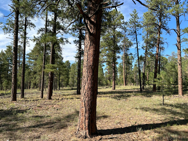
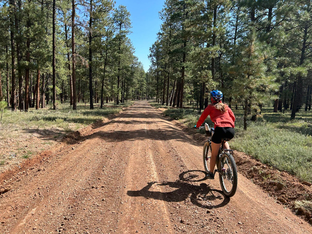
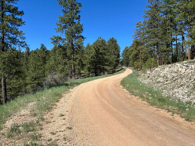
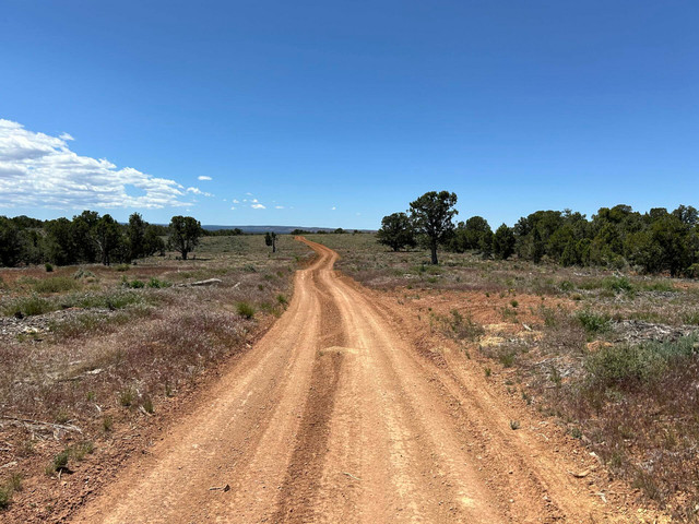
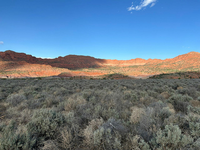
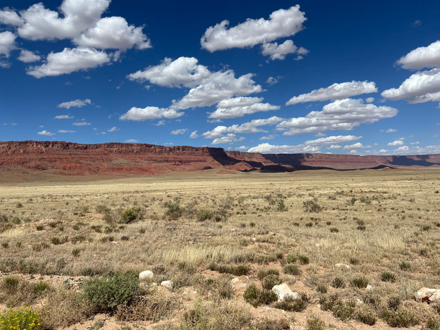
Vermilion Cliffs Condor Tour takes bikepackers along the red butte-faces of Vermilion Cliffs National Monument and climbs through the aspens and pines of the northern Kaibab Plateau. Full Route Guide: https://www.theforrestbiome.com/vermilion-cliffs-overnighter
Surface Color Guide
- Purple = Improved Dirt Surface (Frequently Maintained, Usually Smoother)
- Red = Rugged Dirt Surface (Infrequently Maintained, Typically Rougher/Rockier)
- Brown = Primitive Dirt Surface (Rarely/Never Maintained, Particularly Rocky/Rutted/Eroded)
- Blue = Vehicular Pavement
Route Details
Other routes by Forrest Radarian
South Rim - Capes of the Canyon
Northern Arizona Bikepacking and Adventure Riding
The South Rim Capes of the Canyon provides a backcountry ride through the southern landscape of G... more
The South Rim Capes of the Canyon provides a backcountry ride through the southern landscape of Grand Canyon National Park and the Baaj Nwaavjo I'tah Kukveni National Monument. From pinyon-juniper grasslands blanketing the base of Red Butte to towering ponderosa stands along the Coconino Rim that spill to limestone at Canyon edge, this route provides bikepackers an opportunity to see the Grand Canyon region. Full Route Guide: https://www.theforrestbiome.com/capes-of-the-canyon-southrim
Surface Color Guide
- Purple = Improved Dirt Surface (Frequently Maintained, Usually Smoother)
- Red = Rugged Dirt Surface (Infrequently Maintained, Typically Rougher/Rockier)
- Brown = Primitive Dirt Surface (Rarely/Never Maintained, Particularly Rocky/Rutted/Eroded)
- Black = Singletrack
- Yellow = Hiking Trail (must park bike and hike/walk)
- Blue = Vehicular Pavement
- Green = Paved Bike Path (less)
The South Rim Capes of the Canyon provides a backcountry ride through the southern landscape of Grand Canyon National Park and the Baaj Nwaavjo I'tah Kukveni National Monument. From pinyon-juniper grasslands...more
The South Rim Capes of the Canyon provides a backcountry ride through the southern landscape of Grand Canyon National Park and the Baaj Nwaavjo I'tah Kukveni National Monument. From pinyon-juniper grasslands blanketing the base of Red Butte to towering ponderosa stands along the Coconino Rim that spill to limestone at Canyon edge, this route provides bikepackers an opportunity to see the Grand Canyon region. Full Route Guide: https://www.theforrestbiome.com/capes-of-the-canyon-southrim
Surface Color Guide
- Purple = Improved Dirt Surface (Frequently Maintained, Usually Smoother)
- Red = Rugged Dirt Surface (Infrequently Maintained, Typically Rougher/Rockier)
- Brown = Primitive Dirt Surface (Rarely/Never Maintained, Particularly Rocky/Rutted/Eroded)
- Black = Singletrack
- Yellow = Hiking Trail (must park bike and hike/walk)
- Blue = Vehicular Pavement
- Green = Paved Bike Path (less)
Gold to Grand Loop
Northern Arizona Bikepacking and Adventure Riding
Gold to Grand Loop takes bikepackers on a desert ride through Gold Butte and Grand Canyon-Parasha... more
Gold to Grand Loop takes bikepackers on a desert ride through Gold Butte and Grand Canyon-Parashant National Monuments along the Nevada/Arizona border. The route travels across the vast arid basins of the Mojave Desert in addition to tracing and climbing over the pinyon-studded Virgin Mountains. Full Route Guide: https://www.theforrestbiome.com/gold-to-grand-loop
Surface Color Guide
- Red = Dirt Surface (Rugged, Smooth, or Sandy; Variously Maintained; Doubletrack to Wide)
- Brown = Primitive Dirt Surface (Rarely/Never Maintained, Particularly Rocky/Rutted/Eroded)
- Blue = Vehicular Pavement
- Green = Paved Bike Path
- Yellow = Hiking Trail (must park bike and hike/walk) (less)
Gold to Grand Loop takes bikepackers on a desert ride through Gold Butte and Grand Canyon-Parashant National Monuments along the Nevada/Arizona border. The route travels across the vast arid basins of the M...more
Gold to Grand Loop takes bikepackers on a desert ride through Gold Butte and Grand Canyon-Parashant National Monuments along the Nevada/Arizona border. The route travels across the vast arid basins of the Mojave Desert in addition to tracing and climbing over the pinyon-studded Virgin Mountains. Full Route Guide: https://www.theforrestbiome.com/gold-to-grand-loop
Surface Color Guide
- Red = Dirt Surface (Rugged, Smooth, or Sandy; Variously Maintained; Doubletrack to Wide)
- Brown = Primitive Dirt Surface (Rarely/Never Maintained, Particularly Rocky/Rutted/Eroded)
- Blue = Vehicular Pavement
- Green = Paved Bike Path
- Yellow = Hiking Trail (must park bike and hike/walk) (less)
House Rock Wrap
Northern Arizona Bikepacking and Adventure Riding
House Rock Wrap takes bikepackers on a wraparound traverse across House Rock Valley to viewpoints... more
House Rock Wrap takes bikepackers on a wraparound traverse across House Rock Valley to viewpoints of Marble Canyon. Riders can expect to visit and camp rim-side at Pronghorn, Bedrock, South Canyon, Buck Farm, and Triple Alcove points.
Full Route Guide: https://www.theforrestbiome.com/house-rock-wrap
Surface Color Guide
- Purple = Improved Dirt Surface (Frequently Maintained, Usually Smoother)
- Red = Rugged Dirt Surface (Infrequently Maintained, Typically Rougher/Rockier)
- Brown = Primitive Dirt Surface (Rarely/Never Maintained, Particularly Rocky/Rutted/Eroded)
- Yellow = Sand (Intermittent with Hard Pack; Mild/Medium Depth)
- Black = Hiking Trail - No Bikes Allowed
- Blue = Vehicular Pavement (less)
House Rock Wrap takes bikepackers on a wraparound traverse across House Rock Valley to viewpoints of Marble Canyon. Riders can expect to visit and camp rim-side at Pronghorn, Bedrock, South Canyon, Buck Farm...more
House Rock Wrap takes bikepackers on a wraparound traverse across House Rock Valley to viewpoints of Marble Canyon. Riders can expect to visit and camp rim-side at Pronghorn, Bedrock, South Canyon, Buck Farm, and Triple Alcove points.
Full Route Guide: https://www.theforrestbiome.com/house-rock-wrap
Surface Color Guide
- Purple = Improved Dirt Surface (Frequently Maintained, Usually Smoother)
- Red = Rugged Dirt Surface (Infrequently Maintained, Typically Rougher/Rockier)
- Brown = Primitive Dirt Surface (Rarely/Never Maintained, Particularly Rocky/Rutted/Eroded)
- Yellow = Sand (Intermittent with Hard Pack; Mild/Medium Depth)
- Black = Hiking Trail - No Bikes Allowed
- Blue = Vehicular Pavement (less)
Rainbow Rim Tour
Northern Arizona Bikepacking and Adventure Riding
Rainbow Rim Tour takes riders out to famous Rainbow Rim, which is the sole opportunity for mounta... more
Rainbow Rim Tour takes riders out to famous Rainbow Rim, which is the sole opportunity for mountain bikers to ride singletrack along the rim of Grand Canyon National Park. Full Route Guide: https://www.theforrestbiome.com/rainbow-rim-overnighter
Surface Color Guide
- Purple = Improved Dirt Surface (Frequently Maintained, Usually Smoother)
- Red = Rugged Dirt Surface (Infrequently Maintained, Typically Rougher/Rockier)
- Brown = Primitive Dirt Surface (Rarely/Never Maintained, Particularly Rocky/Rutted/Eroded)
- Black = Singletrack
- Blue = Vehicular Pavement (less)
Rainbow Rim Tour takes riders out to famous Rainbow Rim, which is the sole opportunity for mountain bikers to ride singletrack along the rim of Grand Canyon National Park. Full Route Guide: https://www.thef...more
Rainbow Rim Tour takes riders out to famous Rainbow Rim, which is the sole opportunity for mountain bikers to ride singletrack along the rim of Grand Canyon National Park. Full Route Guide: https://www.theforrestbiome.com/rainbow-rim-overnighter
Surface Color Guide
- Purple = Improved Dirt Surface (Frequently Maintained, Usually Smoother)
- Red = Rugged Dirt Surface (Infrequently Maintained, Typically Rougher/Rockier)
- Brown = Primitive Dirt Surface (Rarely/Never Maintained, Particularly Rocky/Rutted/Eroded)
- Black = Singletrack
- Blue = Vehicular Pavement (less)
Jumpup Epic
Northern Arizona Bikepacking and Adventure Riding
Jumpup Epic is a spectacular ride to one of the most remote viewpoints off the North Rim on the K... more
Jumpup Epic is a spectacular ride to one of the most remote viewpoints off the North Rim on the Kaibab Plateau. Bikepackers get a chance to stay overnight in historic US Forest Services cabins at Big Springs and Jumpup. They also get to camp rimside at Jumpup Point where views of the crimson Esplanade stretch within the Kanab Creek Wilderness. Full Route Guide: https://www.theforrestbiome.com/jumpup-overnighter
Surface Color Guide
- Purple = Improved Dirt Surface (Frequently Maintained, Usually Smoother)
- Red = Rugged Dirt Surface (Infrequently Maintained, Typically Rougher/Rockier)
- Blue = Vehicular Pavement (less)
Jumpup Epic is a spectacular ride to one of the most remote viewpoints off the North Rim on the Kaibab Plateau. Bikepackers get a chance to stay overnight in historic US Forest Services cabins at Big Spring...more
Jumpup Epic is a spectacular ride to one of the most remote viewpoints off the North Rim on the Kaibab Plateau. Bikepackers get a chance to stay overnight in historic US Forest Services cabins at Big Springs and Jumpup. They also get to camp rimside at Jumpup Point where views of the crimson Esplanade stretch within the Kanab Creek Wilderness. Full Route Guide: https://www.theforrestbiome.com/jumpup-overnighter
Surface Color Guide
- Purple = Improved Dirt Surface (Frequently Maintained, Usually Smoother)
- Red = Rugged Dirt Surface (Infrequently Maintained, Typically Rougher/Rockier)
- Blue = Vehicular Pavement (less)
Crazy Jug Loco Loop
Northern Arizona Bikepacking and Adventure Riding
Crazy Jug Loco Loop provides riders a chance to camp rim-side at Crazy Jug Point along the Grand ... more
Crazy Jug Loco Loop provides riders a chance to camp rim-side at Crazy Jug Point along the Grand Canyon's North Rim. The route also provides short hikes with vast views from Monument Point and Thunder River. Full Route Guide: https://www.theforrestbiome.com/crazy-jug-overnighter
Surface Color Guide
- Purple = Improved Dirt Surface (Frequently Maintained, Usually Smoother)
- Red = Rugged Dirt Surface (Infrequently Maintained, Typically Rougher/Rockier)
- Brown = Primitive Dirt Surface (Rarely/Never Maintained, Particularly Rocky/Rutted/Eroded) (less)
Crazy Jug Loco Loop provides riders a chance to camp rim-side at Crazy Jug Point along the Grand Canyon's North Rim. The route also provides short hikes with vast views from Monument Point and Thunder River...more
Crazy Jug Loco Loop provides riders a chance to camp rim-side at Crazy Jug Point along the Grand Canyon's North Rim. The route also provides short hikes with vast views from Monument Point and Thunder River. Full Route Guide: https://www.theforrestbiome.com/crazy-jug-overnighter
Surface Color Guide
- Purple = Improved Dirt Surface (Frequently Maintained, Usually Smoother)
- Red = Rugged Dirt Surface (Infrequently Maintained, Typically Rougher/Rockier)
- Brown = Primitive Dirt Surface (Rarely/Never Maintained, Particularly Rocky/Rutted/Eroded) (less)
Desert View Declivity
Northern Arizona Bikepacking and Adventure Riding
Desert View Declivity takes riders to a chain of viewpoints along the eastern portion of Grand Ca... more
Desert View Declivity takes riders to a chain of viewpoints along the eastern portion of Grand Canyon National Park's South Rim. The route travels down chunky doubletrack and along smooth pavement from overlooks of the Little Colorado River Gorge to Desert View Watchtower. Full Route Guide: https://www.theforrestbiome.com/desert-view-overnighter
Surface Color Guide
- Purple = Improved Dirt Surface (Frequently Maintained, Usually Smoother)
- Red = Rugged Dirt Surface (Infrequently Maintained, Typically Rougher/Rockier)
- Brown = Primitive Dirt Surface (Rarely/Never Maintained, Particularly Rocky/Rutted/Eroded)
- Black = Singletrack
- Yellow = Hiking Trail (must park bike and hike/walk)
- Blue = Vehicular Pavement
- Green = Paved Bike Path (less)
Desert View Declivity takes riders to a chain of viewpoints along the eastern portion of Grand Canyon National Park's South Rim. The route travels down chunky doubletrack and along smooth pavement from over...more
Desert View Declivity takes riders to a chain of viewpoints along the eastern portion of Grand Canyon National Park's South Rim. The route travels down chunky doubletrack and along smooth pavement from overlooks of the Little Colorado River Gorge to Desert View Watchtower. Full Route Guide: https://www.theforrestbiome.com/desert-view-overnighter
Surface Color Guide
- Purple = Improved Dirt Surface (Frequently Maintained, Usually Smoother)
- Red = Rugged Dirt Surface (Infrequently Maintained, Typically Rougher/Rockier)
- Brown = Primitive Dirt Surface (Rarely/Never Maintained, Particularly Rocky/Rutted/Eroded)
- Black = Singletrack
- Yellow = Hiking Trail (must park bike and hike/walk)
- Blue = Vehicular Pavement
- Green = Paved Bike Path (less)
Grandview Grand Tour
Northern Arizona Bikepacking and Adventure Riding
Grandview Grand Tour travels down wide dirt roads into the forested heart of the Baaj Nwaavjo I't... more
Grandview Grand Tour travels down wide dirt roads into the forested heart of the Baaj Nwaavjo I'tah Kukveni Natonal Monument before looping along pavement and greenways past viewpoints of Grand Canyon National Park on the South Rim. Full Route Guide: https://www.theforrestbiome.com/grandview-overnighter
Surface Color Guide
- Purple = Improved Dirt Surface (Frequently Maintained, Usually Smoother)
- Red = Rugged Dirt Surface (Infrequently Maintained, Typically Rougher/Rockier)
- Yellow = Hiking Trail (must park bike and hike/walk)
- Blue = Vehicular Pavement
- Green = Paved Bike Path
- Black = Singletrack (less)
Grandview Grand Tour travels down wide dirt roads into the forested heart of the Baaj Nwaavjo I'tah Kukveni Natonal Monument before looping along pavement and greenways past viewpoints of Grand Canyon Nation...more
Grandview Grand Tour travels down wide dirt roads into the forested heart of the Baaj Nwaavjo I'tah Kukveni Natonal Monument before looping along pavement and greenways past viewpoints of Grand Canyon National Park on the South Rim. Full Route Guide: https://www.theforrestbiome.com/grandview-overnighter
Surface Color Guide
- Purple = Improved Dirt Surface (Frequently Maintained, Usually Smoother)
- Red = Rugged Dirt Surface (Infrequently Maintained, Typically Rougher/Rockier)
- Yellow = Hiking Trail (must park bike and hike/walk)
- Blue = Vehicular Pavement
- Green = Paved Bike Path
- Black = Singletrack (less)
El Lobo Lupus
Northern Arizona Bikepacking and Adventure Riding
El Lobo Lupus takes bikepackers through the high elevation heart of the White Mountains, Blue Ran... more
El Lobo Lupus takes bikepackers through the high elevation heart of the White Mountains, Blue Range, and Mogollon Rim of eastern Arizona where the Mexican Gray Wolf has been reintroduced. The route name “Lupus” reflects the track’s looping path and its goal of providing riders the opportunity to see Mexican Wolves (Canis lupus baileyi), commonly called "El Lobo." Full Route Guide: https://www.theforrestbiome.com/el-lobo-lupus
Surface Color Guide
- Purple = Improved Dirt Surface (Frequently Maintained, Usually Smoother)
- Red = Rugged Dirt Surface (Infrequently Maintained, Typically Rougher/Rockier)
- Brown = Primitive Dirt Surface (Rarely/Never Maintained, Particularly Rocky/Rutted/Eroded)
- Black = Singletrack
- Yellow = Hiking Trail (must park bike and hike/walk)
- Blue = Vehicular Pavement (less)
El Lobo Lupus takes bikepackers through the high elevation heart of the White Mountains, Blue Range, and Mogollon Rim of eastern Arizona where the Mexican Gray Wolf has been reintroduced. The route name “Lu...more
El Lobo Lupus takes bikepackers through the high elevation heart of the White Mountains, Blue Range, and Mogollon Rim of eastern Arizona where the Mexican Gray Wolf has been reintroduced. The route name “Lupus” reflects the track’s looping path and its goal of providing riders the opportunity to see Mexican Wolves (Canis lupus baileyi), commonly called "El Lobo." Full Route Guide: https://www.theforrestbiome.com/el-lobo-lupus
Surface Color Guide
- Purple = Improved Dirt Surface (Frequently Maintained, Usually Smoother)
- Red = Rugged Dirt Surface (Infrequently Maintained, Typically Rougher/Rockier)
- Brown = Primitive Dirt Surface (Rarely/Never Maintained, Particularly Rocky/Rutted/Eroded)
- Black = Singletrack
- Yellow = Hiking Trail (must park bike and hike/walk)
- Blue = Vehicular Pavement (less)
North Rim - Capes of the Canyon
Northern Arizona Bikepacking and Adventure Riding
The North Rim Capes of the Canyon takes bikepackers from the desert base of Vermilion Cliffs Nati... more
The North Rim Capes of the Canyon takes bikepackers from the desert base of Vermilion Cliffs National Monument to the subalpine meadows and sprawling aspen forests of the Kaibab Plateau. In-between, it weaves a circumference dirt tour of North Rim viewpoints along the edge of Grand Canyon National Park. Full Route Guide: https://www.theforrestbiome.com/capes-of-the-canyon-northrim
Surface Color Guide
- Purple = Improved Dirt Surface (Frequently Maintained, Usually Smoother)
- Red = Rugged Dirt Surface (Infrequently Maintained, Typically Rougher/Rockier)
- Brown = Primitive Dirt Surface (Rarely/Never Maintained, Particularly Rocky/Rutted/Eroded)
- Black = Singletrack
- Yellow = Hiking Trail (must park bike and hike/walk)
- Blue = Vehicular Pavement
- Green = Dirt Multi-Use Path (less)
The North Rim Capes of the Canyon takes bikepackers from the desert base of Vermilion Cliffs National Monument to the subalpine meadows and sprawling aspen forests of the Kaibab Plateau. In-between, it weave...more
The North Rim Capes of the Canyon takes bikepackers from the desert base of Vermilion Cliffs National Monument to the subalpine meadows and sprawling aspen forests of the Kaibab Plateau. In-between, it weaves a circumference dirt tour of North Rim viewpoints along the edge of Grand Canyon National Park. Full Route Guide: https://www.theforrestbiome.com/capes-of-the-canyon-northrim
Surface Color Guide
- Purple = Improved Dirt Surface (Frequently Maintained, Usually Smoother)
- Red = Rugged Dirt Surface (Infrequently Maintained, Typically Rougher/Rockier)
- Brown = Primitive Dirt Surface (Rarely/Never Maintained, Particularly Rocky/Rutted/Eroded)
- Black = Singletrack
- Yellow = Hiking Trail (must park bike and hike/walk)
- Blue = Vehicular Pavement
- Green = Dirt Multi-Use Path (less)
Point Sublime Loop
Northern Arizona Bikepacking and Adventure Riding
Point Sublime Loop takes bikepackers on a loop out to remote and iconic Point Sublime in Grand Ca... more
Point Sublime Loop takes bikepackers on a loop out to remote and iconic Point Sublime in Grand Canyon National Park. This viewpoint is famous for its campsite on the North Rim where a night is spent on a fin of land jutting into the chasm. Full Route Guide: https://www.theforrestbiome.com/point-sublime-overnighter
Surface Color Guide
- Purple = Improved Dirt Surface (Frequently Maintained, Usually Smoother)
- Red = Rugged Dirt Surface (Infrequently Maintained, Typically Rougher/Rockier)
- Brown = Primitive Dirt Surface (Rarely/Never Maintained, Particularly Rocky/Rutted/Eroded)
- Black = Singletrack
- Yellow = Hiking Trail (must park bike and hike/walk)
- Blue = Vehicular Pavement
- Green = Dirt Multi-Use Path (less)
Point Sublime Loop takes bikepackers on a loop out to remote and iconic Point Sublime in Grand Canyon National Park. This viewpoint is famous for its campsite on the North Rim where a night is spent on a fi...more
Point Sublime Loop takes bikepackers on a loop out to remote and iconic Point Sublime in Grand Canyon National Park. This viewpoint is famous for its campsite on the North Rim where a night is spent on a fin of land jutting into the chasm. Full Route Guide: https://www.theforrestbiome.com/point-sublime-overnighter
Surface Color Guide
- Purple = Improved Dirt Surface (Frequently Maintained, Usually Smoother)
- Red = Rugged Dirt Surface (Infrequently Maintained, Typically Rougher/Rockier)
- Brown = Primitive Dirt Surface (Rarely/Never Maintained, Particularly Rocky/Rutted/Eroded)
- Black = Singletrack
- Yellow = Hiking Trail (must park bike and hike/walk)
- Blue = Vehicular Pavement
- Green = Dirt Multi-Use Path (less)
South Bass Scenic Divide
Northern Arizona Bikepacking and Adventure Riding
South Bass Scenic Divide is a rare opportunity for bikepackers to camp on the edge of Grand Canyo... more
South Bass Scenic Divide is a rare opportunity for bikepackers to camp on the edge of Grand Canyon's South Rim in an area excluding cars. The route provides a tour from Grand Canyon Village out to remote Havasupai Point by way of pinyon-juniper woodlands and sage-filled grasslands. Full Route Guide: https://www.theforrestbiome.com/south-bass-overnighter
Surface Color Guide
- Purple = Improved Dirt Surface (Frequently Maintained, Usually Smoother)
- Red = Rugged Dirt Surface (Infrequently Maintained, Typically Rougher/Rockier)
- Brown = Primitive Dirt Surface (Rarely/Never Maintained, Particularly Rocky/Rutted/Eroded)
- Blue = Vehicular Pavement
- Green = Paved Bike Path
- Yellow = Hiking Trail (must park bike and hike/walk) (less)
South Bass Scenic Divide is a rare opportunity for bikepackers to camp on the edge of Grand Canyon's South Rim in an area excluding cars. The route provides a tour from Grand Canyon Village out to remote Ha...more
South Bass Scenic Divide is a rare opportunity for bikepackers to camp on the edge of Grand Canyon's South Rim in an area excluding cars. The route provides a tour from Grand Canyon Village out to remote Havasupai Point by way of pinyon-juniper woodlands and sage-filled grasslands. Full Route Guide: https://www.theforrestbiome.com/south-bass-overnighter
Surface Color Guide
- Purple = Improved Dirt Surface (Frequently Maintained, Usually Smoother)
- Red = Rugged Dirt Surface (Infrequently Maintained, Typically Rougher/Rockier)
- Brown = Primitive Dirt Surface (Rarely/Never Maintained, Particularly Rocky/Rutted/Eroded)
- Blue = Vehicular Pavement
- Green = Paved Bike Path
- Yellow = Hiking Trail (must park bike and hike/walk) (less)
East Rim Edge
Northern Arizona Bikepacking and Adventure Riding
East Rim Edge is a chance to bike out to four capes on the eastern portion of the Kaibab Plateau.... more
East Rim Edge is a chance to bike out to four capes on the eastern portion of the Kaibab Plateau. The views are expansive and far as you gaze out across the Baaj Nwaavjo I'tah National Monument, Marble Canyon, Grand Canyon, Navajo Mountain, Vermilion Cliffs, and even the distant Grand Staircase Escalante. Full Route Guide: https://www.theforrestbiome.com/east-rim-overnighter
Surface Color Guide
- Purple = Improved Dirt Surface (Frequently Maintained, Usually Smoother)
- Red = Rugged Dirt Surface (Infrequently Maintained, Typically Rougher/Rockier)
- Black = Singletrack
- Blue = Vehicular Pavement (less)
East Rim Edge is a chance to bike out to four capes on the eastern portion of the Kaibab Plateau. The views are expansive and far as you gaze out across the Baaj Nwaavjo I'tah National Monument, Marble Canyo...more
East Rim Edge is a chance to bike out to four capes on the eastern portion of the Kaibab Plateau. The views are expansive and far as you gaze out across the Baaj Nwaavjo I'tah National Monument, Marble Canyon, Grand Canyon, Navajo Mountain, Vermilion Cliffs, and even the distant Grand Staircase Escalante. Full Route Guide: https://www.theforrestbiome.com/east-rim-overnighter
Surface Color Guide
- Purple = Improved Dirt Surface (Frequently Maintained, Usually Smoother)
- Red = Rugged Dirt Surface (Infrequently Maintained, Typically Rougher/Rockier)
- Black = Singletrack
- Blue = Vehicular Pavement (less)
Kaibab Spine
Northern Arizona Bikepacking and Adventure Riding
Kaibab Spine is a high-elevation ride across the sprawling montane and subalpine forests and mead... more
Kaibab Spine is a high-elevation ride across the sprawling montane and subalpine forests and meadows of the Kaibab Plateau on the North Rim of the Grand Canyon. Full Route Guide: https://www.theforrestbiome.com/kaibab-spine-overnighter
Surface Color Guide
- Purple = Improved Dirt Surface (Frequently Maintained, Usually Smoother)
- Red = Rugged Dirt Surface (Infrequently Maintained, Typically Rougher/Rockier)
- Blue = Vehicular Pavement (less)
Kaibab Spine is a high-elevation ride across the sprawling montane and subalpine forests and meadows of the Kaibab Plateau on the North Rim of the Grand Canyon. Full Route Guide: https://www.theforrestbiome...more
Kaibab Spine is a high-elevation ride across the sprawling montane and subalpine forests and meadows of the Kaibab Plateau on the North Rim of the Grand Canyon. Full Route Guide: https://www.theforrestbiome.com/kaibab-spine-overnighter
Surface Color Guide
- Purple = Improved Dirt Surface (Frequently Maintained, Usually Smoother)
- Red = Rugged Dirt Surface (Infrequently Maintained, Typically Rougher/Rockier)
- Blue = Vehicular Pavement (less)
Red Butte Wii'i Gdwiisa Tour
Northern Arizona Bikepacking and Adventure Riding
Red Butte Wii'i Gdwiisa Tour takes bikepackers on a loop ride out to culturally significant Red B... more
Red Butte Wii'i Gdwiisa Tour takes bikepackers on a loop ride out to culturally significant Red Butte in the heart of the Baaj Nwaavjo I'tah Kukveni National Monument. This rise of rock is iconic amid the pinyon-juniper grasslands against the skyline of the South Rim; it is also considered the birthplace of the Havasupai people. Full Route Guide: https://www.theforrestbiome.com/red-butte-overnighter
Surface Color Guide
- Purple = Improved Dirt Surface (Frequently Maintained, Usually Smoother)
- Red = Rugged Dirt Surface (Infrequently Maintained, Typically Rougher/Rockier)
- Brown = Primitive Dirt Surface (Rarely/Never Maintained, Particularly Rocky/Rutted/Eroded)
- Yellow = Hiking Trail (must park bike and hike/walk)
- Green = Paved Bike Path (less)
Red Butte Wii'i Gdwiisa Tour takes bikepackers on a loop ride out to culturally significant Red Butte in the heart of the Baaj Nwaavjo I'tah Kukveni National Monument. This rise of rock is iconic amid the pi...more
Red Butte Wii'i Gdwiisa Tour takes bikepackers on a loop ride out to culturally significant Red Butte in the heart of the Baaj Nwaavjo I'tah Kukveni National Monument. This rise of rock is iconic amid the pinyon-juniper grasslands against the skyline of the South Rim; it is also considered the birthplace of the Havasupai people. Full Route Guide: https://www.theforrestbiome.com/red-butte-overnighter
Surface Color Guide
- Purple = Improved Dirt Surface (Frequently Maintained, Usually Smoother)
- Red = Rugged Dirt Surface (Infrequently Maintained, Typically Rougher/Rockier)
- Brown = Primitive Dirt Surface (Rarely/Never Maintained, Particularly Rocky/Rutted/Eroded)
- Yellow = Hiking Trail (must park bike and hike/walk)
- Green = Paved Bike Path (less)

