Overview
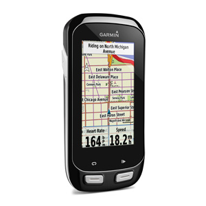
Setting Up Your Edge 1000
There are a few settings we recommend changing on the Edge 1000 to give you the best navigation experience. There are many settings available on the unit, but this should get you going.
First, review your Activity Profiles. The Edge 1000 is similar to the 810 in that you can have different settings based on different profiles. This allows you to associate different speed/cadence sensors with different profiles, so that way wheel size is always correct. Additionally, it lets you change per-activity routing options, which is useful if you use the 1000’s routing system to calculate a route for you (not as helpful for loading pre-planned routes).
Once you have setup your Activity Profiles, let’s move on to navigation specific settings.
- Click the Settings Icon at the bottom of the home screen
- Select Activity Profiles then select your preferred profile (Train in my case)
- Select Navigation, then select Routing
- Set Routing Mode to Road Cycling
- Set Calculation Method to Minimize Distance (though Minimize Time shouldn’t be too different)
- Ensure Lock On Road is set to Off
- Select Avoidance Setup and make sure all options are disabled. Since we are loading pre-planned routes onto the Edge, we don’t want it recalculating the route on us if it thinks there may be a toll, highway etc.
- Set Recalculation to Prompted or Disabled. If you lose GPS signal, or go slightly off course for a block or two, with recalculation enabled the Garmin has a tendency to shortcut you to the end of your ride with whatever it feels is the quickest way. This is almost always not what you want! By setting it to prompted, you can choose to recalculate or not.
Optionally, some users strongly prefer the map always be displayed with North at the top of the map. The default setting on the Garmin is for the map to always rotate so your current heading is towards the top of the map. To change this:
- Select the Settings Icon at the bottom of the home screen
- Select Activity Profiles then select your preferred profile (Train in my case)
- Select Navigation, then select Map
- Change Orientation to be North Up. You can also experiment with 3D mode.
How do I load A Route Onto The Unit?
For a more detailed example of how to get a route to your Edge 1000, see Export Routes to Garmin Devices.
Before exporting your routes, try to limit the name to 15 characters or less for TCX files or 21 characters or less for GPX files.
Here’s a quick step-by-step:
- Plug in your Garmin
- On the website, navigate to your route or ride
- Otherwise, click the Export tab then click on your desired filetype: TCX Course, GPX Track, or FIT Course
- If your computer prompts you to save the file to a specific location, place it somewhere memorable like the desktop.
- Using the Finder, My Computer or other tool on your computer, open up the drive associated with the Garmin, usually labeled Garmin
- Open the Garmin folder located inside the Garmin drive.
- Click/drag the exported file from your desktop to the NewFiles folder.
- Safely remove the Garmin (Eject on an Apple machine) and unplug it from the computer
- After powering it on click the Courses icon and locate your route
What File Format Should I Use?
The Edge 1000 can use GPX Track, TCX, or FIT Course files. A TCX Course has the advantage of embedding your planned route’s cuesheet. So, alongside Garmin’s dedicated navigation, you get beeps and text for each pre-planned cue entry in the cuesheet. This is especially helpful if you have custom cuesheet entries, as well as a nice double check to Garmin’s own navigation.
The downside to a TCX file for navigation is the Virtual Partner. When we create a TCX Course file for a pre-planned route, we have to embed fake timestamps on each point, which is used for the virtual partner speed on the GPS unit. As a result, you’ll end up racing against the virtual partner.
If you load a TCX Course or a TCX History of an uploaded ride on the site (a ride that you or someone else recorded and uploaded to our site) you will get virtual partner speeds identical to the speeds actually ridden along the ride. This is helpful when riding against your previous time, or someone else’s previous time.