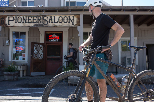
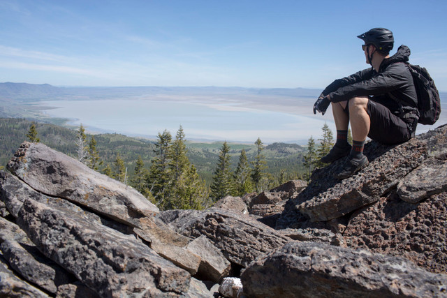
Fremont Tier - Bear Creek Loop

Paisley, OR, US

Route Overview

Oregon Timber Trail

Backcountry mountain biking adventures

47 mi.
4,849 ft.

A long gravel climb with jaw dropping views with a raw and rugged singletrack descent.

Route Details

We saved the best (and hardest) for our last day exploring Oregon’s splendid outback. We had heard talk of Winter Rim, a spectacular fault scarp that rises 3,000’ from the Summer Lake valley floor—some of the most dramatic topography in Oregon’s basin and range country. The landscape here varies between marshy meadows, groves of rustling aspen, and giant swaths of wildfire burns in various stages of succession. The Wild and Scenic Sycan River drains off the gradual western slopes into the headwaters of the Klamath River and eventually to the ocean through one of the most important salmon fisheries in the northwest. The Chewaucan River—where we’ve set up camp—drains the other direction: east—and eventually dead ends in the alkali Lake Abert where it evaporates with a threatened population of brine shrimp and hungry migrating shorebirds. Contrasts are an ongoing theme in this stark landscape.

The Bear Creek ride is almost 50 miles long so we started at daybreak and immediately began a gradual climb up the south slopes of Winter Rim. The Summer Lake valley stretched out below us slowly filling with the morning sun’s hazy light. Although this first climb was nine miles long, the grade was reasonable and the views astounding. Soon we were descending past recent burns under Slide Mountain and gazing out along the full length of Summer Lake before beginning the second climb to the top of Government Harvey Pass. Once up the climb and on the rim we had covered half our 50 miles, but as we turned off the gravel onto singletrack nearly all our elevation gain and much of the day was behind us. Less than a mile down the technical rocky singletrack we came upon a stunning lunch stop at the top of a talus field. Here we stopped, and quietly marveled in the almost unbelievable vista below us. Soon we reached the the shoulder of Slide Mountain and began our long descent down Bear Creek.

This entire area burned in a wildfire during the summer of 2018 and it was interesting to see the varying levels of regeneration as we traveled down the twelve mile descent. The ride was interspersed with ripping fast sections, lush green meadows, some shady stands spared by the flames, and a bubbling creek that grew larger as we followed it down into the Chewaucan Valley. Bear Creek had a little bit of everything: views, wildlife, creeks, rock gardens, straightaways, switchbacks, natural features, a little bit of wayfinding, and a stout physical challenge to test our mettle. Once we hit the Chewaucan River we were exhausted and giddy as we rolled the easy paved miles back into Paisley with the sun at our backs and a frosty cold pint waiting for us. These are the type of long days on a bike we’ll remember for a long time.

If you still want a challenging ride but a little less so, leave a car in Paisley and shuttle to Currier Springs before riding the Fremont National Recreation Trail back south.

Lesson learned: The big elevation gain means temps can get chilly and the weather quite breezy along the rim, plan accordingly and pack an extra layer even if the forecast is hot in Paisley.

The Stats:

  • Miles: 47.3
  • Elevation gain: 4,900’
  • Ride time: 6-8 hours
  • Difficulty: Difficult
  • Season: Mid June through early October
  • Closest Town: Paisley
  • Trailhead: This is a (big!) loop right from downtown Paisley. Park near the Saloon if you plan on an after-ride beer or on nearby side streets should be fine too.
  • Camping: Marsters Spring
  • Lodging: Summer Lake Hot Spring Resort

Other routes by Oregon Timber Trail