Devils Gulch, Fish Creek, Mary Lake loop |

|
Route-overzicht
Free Northern Colorado guide service
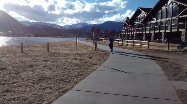
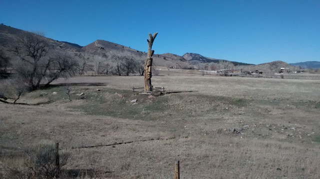
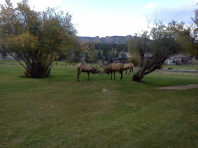
This Route is currently closed due to Construction in Thompson Canyon on US 34 and is expected to remain closed until sumer 2017. This route takes you up Thompson canyon then up Dry Gulch to the Devils gulch descent into Estes park. It continues around lake Estes and tram Mountain via Fish creek and Mary lake roads. Parking is free at Devils backbone trailhead. Get water at the Marina across from dry gulch road (mile 24, 33.2, and 45.4) and lunch at Smokin' Dave's BBQ and Taphouse (mile 42.1).
Routedetails
Andere routes van LOCO Bike Guide
Buckhorn Canyon with Poudre Canyon Horesetooth Mt return.
Free Northern Colorado guide service
This ride features the remoteness of the cat 1 climb up Buckhorn Canyon, a great descent into Pou... more
This ride features the remoteness of the cat 1 climb up Buckhorn Canyon, a great descent into Poudre canyon, the powerful Cache La Poudre River and a roller coaster ride along the hogbacks beside Horsetooth Reservoir. Parking is free at devils backbone. Get water lunch and beer at the Mishawaka (mile 30.2) and refill water at Horsetooth Mt Park (mile 59.4). (less)
This ride features the remoteness of the cat 1 climb up Buckhorn Canyon, a great descent into Poudre canyon, the powerful Cache La Poudre River and a roller coaster ride along the hogbacks beside Horsetooth ...more
This ride features the remoteness of the cat 1 climb up Buckhorn Canyon, a great descent into Poudre canyon, the powerful Cache La Poudre River and a roller coaster ride along the hogbacks beside Horsetooth Reservoir. Parking is free at devils backbone. Get water lunch and beer at the Mishawaka (mile 30.2) and refill water at Horsetooth Mt Park (mile 59.4). (less)
Lakes Loop with side excursions
Free Northern Colorado guide service
This loop takes you up the easier south dam climb to carter lake and past the western and southe... more
This loop takes you up the easier south dam climb to carter lake and past the western and southern side of Horsetooth reservoir. The loop features rolling hills with views of mountains, red rock formations and beautiful lakes but no steep climbs. Parking is free at Devils backbone open space. Water is available at the campground across from the carter lake marina store (mile 15.6) and at Horsetooth Mountain Park (mile 34.9). Food and beer are available at Windjammer Road House (mile 16.3) or at canyon grill (mile 42.1). (less)
This loop takes you up the easier south dam climb to carter lake and past the western and southern side of Horsetooth reservoir. The loop features rolling hills with views of mountains, red rock formations...more
This loop takes you up the easier south dam climb to carter lake and past the western and southern side of Horsetooth reservoir. The loop features rolling hills with views of mountains, red rock formations and beautiful lakes but no steep climbs. Parking is free at Devils backbone open space. Water is available at the campground across from the carter lake marina store (mile 15.6) and at Horsetooth Mountain Park (mile 34.9). Food and beer are available at Windjammer Road House (mile 16.3) or at canyon grill (mile 42.1). (less)
Left Hand to Long Lake from Hygiene
Free Northern Colorado guide service
A massive climb, mountain scenery and two spectacular canyons are the highlights of this ride. Th... more
A massive climb, mountain scenery and two spectacular canyons are the highlights of this ride. The climb is ranked 29th in the US by ACE score or 78th ranked by FIETS score. Park at Hygiene Elementary school. Get water at mile marker 16 in Left hand Canyon and lunch at Mill Site Inn north of Ward or Oscar Blues blues in Lyons. Start early with two full water bottles because you will ride 24 miles with 3700 feet of climbing before the water at mile marker 16 in left hand canyon. (less)
A massive climb, mountain scenery and two spectacular canyons are the highlights of this ride. The climb is ranked 29th in the US by ACE score or 78th ranked by FIETS score. Park at Hygiene Elementary school...more
A massive climb, mountain scenery and two spectacular canyons are the highlights of this ride. The climb is ranked 29th in the US by ACE score or 78th ranked by FIETS score. Park at Hygiene Elementary school. Get water at mile marker 16 in Left hand Canyon and lunch at Mill Site Inn north of Ward or Oscar Blues blues in Lyons. Start early with two full water bottles because you will ride 24 miles with 3700 feet of climbing before the water at mile marker 16 in left hand canyon. (less)
Savage Me
Free Northern Colorado guide service
This remote and difficult route takes you up the least climbed HC climb in Colorado. Food and wa... more
This remote and difficult route takes you up the least climbed HC climb in Colorado. Food and water are available at Mishawaka and Verns. The climbing is gratuitously difficult and the descending is technical so your endurance, skill and group's friendship will all be tested on this savage route. (less)
This remote and difficult route takes you up the least climbed HC climb in Colorado. Food and water are available at Mishawaka and Verns. The climbing is gratuitously difficult and the descending is technic...more
This remote and difficult route takes you up the least climbed HC climb in Colorado. Food and water are available at Mishawaka and Verns. The climbing is gratuitously difficult and the descending is technical so your endurance, skill and group's friendship will all be tested on this savage route. (less)
Carter Lake and Apple Valley
Free Northern Colorado guide service
This ride features a short cat 4 climb to beautiful Carter lake , rolling hills, quiet roads, gr... more
This ride features a short cat 4 climb to beautiful Carter lake , rolling hills, quiet roads, great views, a hidden canyon and lunch at Oscar Blues in Lyons (mile 46.7). Get water and a snack at Mary's Market & Deli (mile 29.8). (less)
This ride features a short cat 4 climb to beautiful Carter lake , rolling hills, quiet roads, great views, a hidden canyon and lunch at Oscar Blues in Lyons (mile 46.7). Get water and a snack at Mary's Mar...more
This ride features a short cat 4 climb to beautiful Carter lake , rolling hills, quiet roads, great views, a hidden canyon and lunch at Oscar Blues in Lyons (mile 46.7). Get water and a snack at Mary's Market & Deli (mile 29.8). (less)
South St Vrain Canyon and Peak to Peak into Estes Park.
Free Northern Colorado guide service
This Epic loop is currently closed due to Construction in Thompson Canyon on US 34 and is expecte... more
This Epic loop is currently closed due to Construction in Thompson Canyon on US 34 and is expected to remain closed until sumer 2017. This epic loop starts in rolling farm land before a long climb up South St Vrain Canyon under towering canyon walls. It continues through the quaint town of Raymond to Peak to Peak highway which features majestic mountain views of the eastern side of Rocky Mountain National Park. It then descends into Estes Park for lunch and down Big Thompson Canyon to the starting point. Get water at Oscar Blues (mile 26.5), the Raymond Store (mile 40.5), in Allenspark (mile 48.5) and lunch at Smokin' Dave's BBQ & Taphouse (mile 63.1). (less)
This Epic loop is currently closed due to Construction in Thompson Canyon on US 34 and is expected to remain closed until sumer 2017. This epic loop starts in rolling farm land before a long climb up South ...more
This Epic loop is currently closed due to Construction in Thompson Canyon on US 34 and is expected to remain closed until sumer 2017. This epic loop starts in rolling farm land before a long climb up South St Vrain Canyon under towering canyon walls. It continues through the quaint town of Raymond to Peak to Peak highway which features majestic mountain views of the eastern side of Rocky Mountain National Park. It then descends into Estes Park for lunch and down Big Thompson Canyon to the starting point. Get water at Oscar Blues (mile 26.5), the Raymond Store (mile 40.5), in Allenspark (mile 48.5) and lunch at Smokin' Dave's BBQ & Taphouse (mile 63.1). (less)
Trail Ridge road.
Free Northern Colorado guide service
Colorado has climbs that belong on every cyclist's bucket list and Trail Ridge Road in Rocky Moun... more
Colorado has climbs that belong on every cyclist's bucket list and Trail Ridge Road in Rocky Mountain National Park is my favorite. Park at the Visitor center or Safeway Shopping center near the intersection of US 34 and US 36 on the east side of Estes Park. Exit the parking lot on the east side and loop past the Historic Stanley Hotel on Steamer Drive and Steamer Pkwy before turning right (west) onto Wonderview Ave (US 34). At mile 11.5 turn right into Hidden Valley where you can get water and take a bathroom break. You can get food, drink and shelter at the alpine Visitor center (mile 26.9) which is also you turn around point. You will want to get an early start for this ride so you can be back down off the top before the afternoon storms hit. On the Descent continue strait on US 36 at Deer Ridge Junction. (less)
Colorado has climbs that belong on every cyclist's bucket list and Trail Ridge Road in Rocky Mountain National Park is my favorite. Park at the Visitor center or Safeway Shopping center near the intersection...more
Colorado has climbs that belong on every cyclist's bucket list and Trail Ridge Road in Rocky Mountain National Park is my favorite. Park at the Visitor center or Safeway Shopping center near the intersection of US 34 and US 36 on the east side of Estes Park. Exit the parking lot on the east side and loop past the Historic Stanley Hotel on Steamer Drive and Steamer Pkwy before turning right (west) onto Wonderview Ave (US 34). At mile 11.5 turn right into Hidden Valley where you can get water and take a bathroom break. You can get food, drink and shelter at the alpine Visitor center (mile 26.9) which is also you turn around point. You will want to get an early start for this ride so you can be back down off the top before the afternoon storms hit. On the Descent continue strait on US 36 at Deer Ridge Junction. (less)


