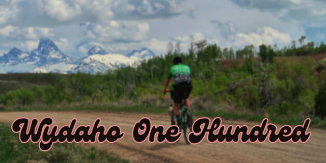
Wydaho One Hundred Official

Teton County, ID, US

Route Overview

Destination Reroute

Adventure cycling & mixed terrain riding in the Greater Yellowstone Ecosystem and beyond.

100 mi.
5,188 ft.

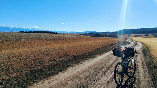
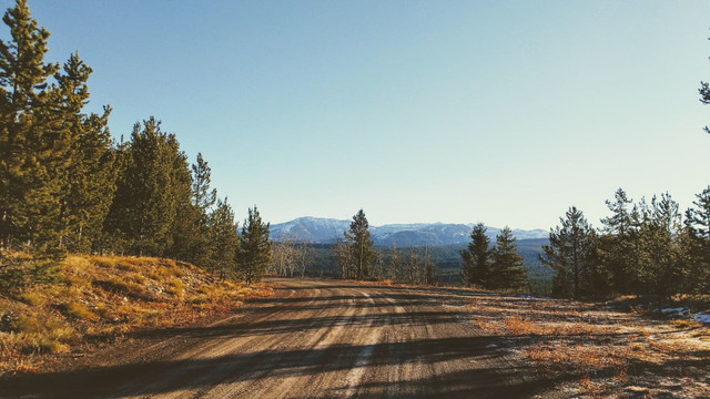
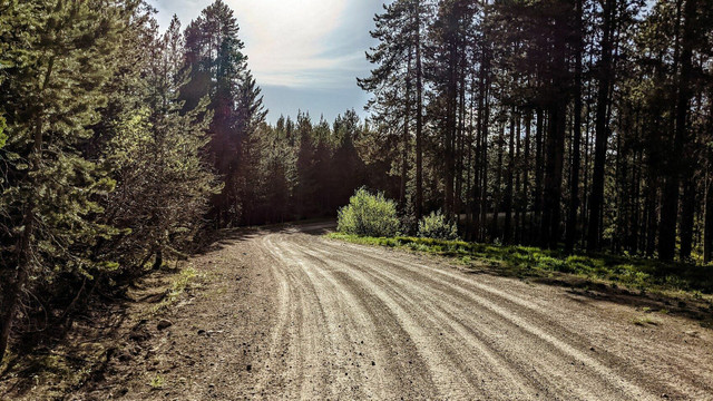
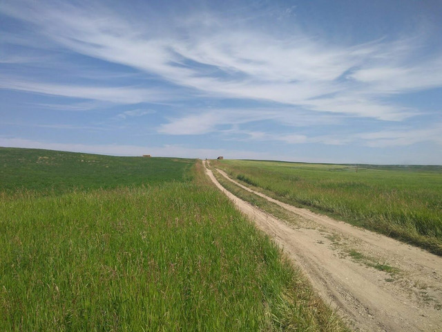
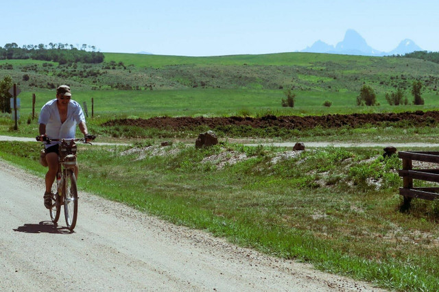
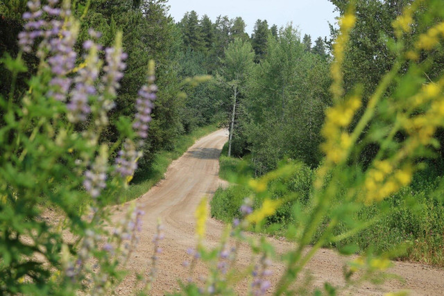
Nestled among three different mountain ranges is a beautiful valley that merges the states of Idaho and Wyoming; a valley we call home, a valley we call Wydaho. The Wydaho One Hundred route follows classic backroads of Eastern Idaho and Western Wyoming, featuring the foothills of the Teton Range, looking into the depths of the Jedediah Smith Wilderness, and the rugged frontcountry of Horseshoe-Packsaddle Canyon in the Big Hole Mountains. This ride completes a 360-degree, 100-mile circumnavigation of Teton Valley, starting and ending in Victor, Idaho.

Surface Key:
RED: Maintained or Smooth Gravel
BLUE: Rough or Rarely Maintained Gravel / Dirt or Natural Surfaces
PINK: Very Rough and Unimproved / Not Maintained / Doubletrack / Dirt or Natural Surfaces
GREEN: Bike Route / Road Alternate Available
BLACK: Paved Road

Please see the route guide for more information.

For questions, route updates or just to say hi, contact me at aaron@destinationreroute.com

There are several route alternates available to add on or bypass along the way found here: https://ridewithgps.com/collections/2842023?privacy_code=qSF0xvTJOZZrgbd0W6kyiPffu4dbEIGy

Read more about this route here: https://destinationreroute.com/wydaho-one-hundred/

Route Details

Route Description

The road surface is predominantly natural surfaces including gravel and dirt as you travel north through the valley on the Wyoming/Idaho Stateline, with portions of broken-up and quiet paved roads that give expansive views of the Teton range and its pinnacles jetting into the sky. The first big climb is Rammell Mountain Road (Forest Road 267) from the valley floor and advancing into the Teton Range. Glimpses of the peaks dance in and out of view as you ascend up the treeline and onto the Jackpine-Pinochle rim, Forest Road 266. There is some relief in the gradual decline traversing the rim bordering the vast Jedediah Smith Wilderness. Take note of all the wildflowers blooming along the road, and the peaks off in the distance, while also being on alert for wildlife -- you are now deep in bear and moose country.

Rounding the corner and leaving the rim, Forest Road 266 merges into the northern portion of the loop road, which descends towards the valley with a few punchy climbs thrown into the mix. This 13-mile descent out of the Tetons rewards you with a rush of adrenaline, and views of the valley below open up offering glimpses of the Big Hole Mountains where the route is headed, but not before traversing the rolling agricultural land accompanied by rutted doubletrack roads.

Once down in the valley, take a detour to the Bitch Creek Trestle bridge! The route follows “roads” that are seldom traveled by any sort of vehicle other than agricultural equipment and ATVs. These county roads pass through environmental easements and farmland providing a unique perspective of the rural landscape and the rugged mountains encompassing it. One should take precautions on these unmaintained roads hammered by cattle, tractors, water and wind erosion, etc. Be prepared to dodge a piece of stray barbed wire, a jagged stone, or a deep rut.

60 miles into the ride is Harrops Bridge -- the first reliable water source since leaving the valley floor and climbing into the Tetons. This spot on the Teton River is a great opportunity to take a refreshing dunk.

A three-mile paved climb on the highway connects into a mellow gradient of the foothills of the Big Hole Mountains, where gravel and dirt roads begin again. Traversing the Packsaddle Bench gives a vantage point of both where you came from in the Teton Range to the east and in the valley below. The rural landscape transitions into a thick forest of conifers and aspens, with short glimpses of prominent points like Ryan Peak and Mount Manning. Despite its close proximity to pavement flanking the canyon on the either end, the Horseshoe-Packsaddle road shouldn’t be underestimated. Expect ruts, large embedded stones, steep descents and hairpin corners, loose rock and dirt, and an occasional downed tree or low-hanging branch. Packsaddle Canyon is a joy to travel through and is abundant with dispersed camping opportunities and water to filter from creeks flowing along side and adjacent to the road. Around mile 74.5 the reward of a second descent comes into view and continues after meeting pavement at the South Fork of Horseshoe Creek. Descending Horseshoe Canyon, there are two cattle guards to be on alert for.

Once out of the canyon, with 21 miles until the finish, the route heads south against the mountains, crossing between pavement and gravel the rest of the way. Though the big climbs are behind you, prepare for short, punchy ones on these rolling roads at the base of the Big Holes.

The Wydaho One Hundred feels remote and beautiful right up to the final mile rolling through the town of Victor and that is what gives riders of this route such a unique perspective in the valley of the Tetons.

Alternative Route Beginning & Ending in Tetonia

The Wydaho One Hundred has been based in and out of Victor due to it’s proximity to the route. However, if choosing to bikepack the route, Victor offers a nice rest stop or resupply on food, water and any services required, including bicycle maintenance.

Starting in Tetonia, head north on Mainstreet (Hwy 33) and take the doubletrack to the right as the highway starts to bend west. Continue north on N 3000 W until it intersects with W 10000 N, just after crossing the bridge over Badger Creek. Winding through the backwoods along the creek, this stunning back road leads you to Rammell Mountain Rd -- getting you to this notorious climb a little sooner than when starting in Victor.

Towards the end of route, heading back to Tetonia, take a left on N 500 W, then a right onto W 6500 N, which intersects with N 1750 W. Turn left and follow the gravel road as it twists and turns as far west as it will take you. At the highway, use the doubletrack for “bonus gravel” and a bit of a buffer from the traffic. Cross over when safe to any of the gravel roads to the south side of the road as you roll towards town, or stay on the highway for a celebratory finish at Badger Creek Cafe or the Tetonia Club!

More resources

Important Reminders & Precautions

  • Best ridden from June to Mid-October (depending on snow/rainfall)
  • This ride takes place almost exclusively on roads open to passenger vehicles, including several highway crossings. Respect the rules of the road, signal upcoming turns, be in control of your speed and use front and rear blinking lights.
  • At mile 48 along the environmental easement the creek crossing is likely to be high in June and early July. Take precautions. If impassable, divert to Reece Road or the rail trail and reconnect with the route.
  • Both sections of Jackpine-Pinochle and Horseshoe-Packsaddle Canyon are prime Grizzly and black bear country. Carry bearspray.
  • Wildlife is abundant in this valley. It is not uncommon to elk, moose, coyote, fox, even a wolf, cougar or bear along these roads. Ride with awareness and respect the wildlife by giving them space.
  • Private land borders much of this route. Remain on the road through these areas and respect private property.
  • Water is limited to filtering or purifying from creeks. There is no potable water or food ressupply on route
  • A gravel or hardtail mountain bike is recommended with a tire width of 45mm to 2.4" for the most comfort and control.
  • Dispersed camping is allowed along the route only on National Forest land, specifically on the Jackpine-Pinochle road and Horseshoe-Packsaddle road.
  • Day Parking in Victor is available at the rail trail trailhead where the route starts. Overnight parking in Victor can be found at gravel lot at Sherman Park. If starting in Tetonia, park at the Ashton-Tetonia Rail Trail Trailhead.

Other routes by Destination Reroute